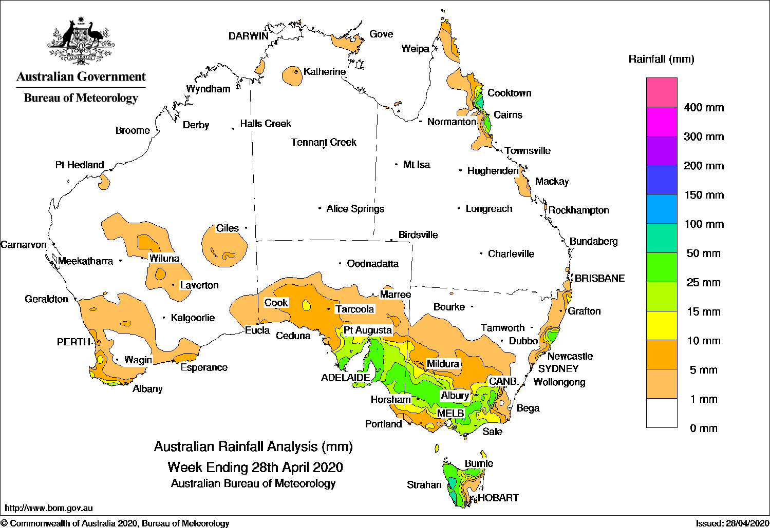
Cold fronts tracked across southern Australia and produced moderate falls in the southeast, while an onshore flow brought showers and moderate falls to the north tropical coast of Queensland.
Past seven days: In the first half of the week, a cold front and pre-frontal trough tracked across southern Victoria and Tasmania, and produced light falls in the southwest and southeast of South Australia, southwestern Victoria, and northern and western Tasmania. Another cold front swept across the Southern Ocean shortly after, with a surface trough ahead of the cold front extending north into Central Australia. Showers and thunderstorms produced mainly light falls in parts of southwest and central Western Australia, and in southwest and southern parts of South Australia. As the cold front tracked eastwards and crossed southeast Australia, moderate falls were recorded in southeast South Australia and western Tasmania, and widespread light falls were reported in southwest and southern New South Wales and in parts of western and northern Victoria around the middle of the week.
In the second half of the week, a cold front embedded in a strong westerly flow and associated cloudband tracked across southern South Australia and southeast Australia. Widespread light to moderate falls were recorded in southern South Australia, most of Victoria, elevated areas of the Snowy Mountains in New South Wales, and western and northern Tasmania. A pair of cold fronts quickly followed, and tracked northeast across Victoria and southern New South Wales, producing moderate falls in Victoria, with localised moderate to heavy falls in mid-north coast New South Wales at the end of the week.
At the end of the week, a cold front brushed southwest Western Australia and produced light rainfall.
Moist onshore flow produced showers and moderate falls along the north tropical coast of Queensland throughout the week, with heavier showers developing.
Rainfall totals in excess of 50 mm were recorded in western Tasmania, small areas in the Manning District in New South Wales, and about the north tropical coast of Queensland. The highest weekly total was 145 mm at Mount Read in Tasmania.
Rainfall totals in excess of 25 mm were recorded in parts of southern and southeastern South Australia, through central western to northeastern Victoria, elevated areas of the Snowy Mountains in New South Wales, parts of the north tropical coast of Queensland, and western and northern Tasmania.
Rainfall totals between 10 mm and 25 mm were recorded in parts of the southwest coast of Western Australia, in southern South Australia, most of Victoria except the southwest, parts of southern and north coast New South Wales, and the north tropical Queensland coast between Cooktown and Ingham.
Highest weekly totals
New South Wales and Australian Capital Territory
51 mm Blackmans Point (The Hatch)
50 mm Yarras (Mount Seaview)
47 mm Perisher Valley AWS
Victoria
49 mm Falls Creek
44 mm Mount Baw Baw
41 mm Mount Buller
Queensland
109 mm Daintree Village
95 mm Low Isles Lighthouse
93 mm Babinda Post Office
Western Australia
22 mm Walpole Forestry
19 mm Windy Harbour
15 mm WitchcliffeMount William
South Australia
58 mm Ashton
56 mm Lenswood (Stringybark), Williamstown
Tasmania
145 mm Mount Read
72 mm Lake Margaret Power Station
69 mm Queenstown (South Queenstown)
Northern Territory
18 mm Katherine Council
4 mm Gove Airport
2 mm Port Keats Airport, Croker Island Airport
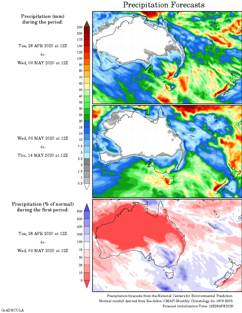
Rainfall outlook
map a bit vague like all weather data could at least have state boundaries and some towns so we can atleast see if we are in or out of rain zone