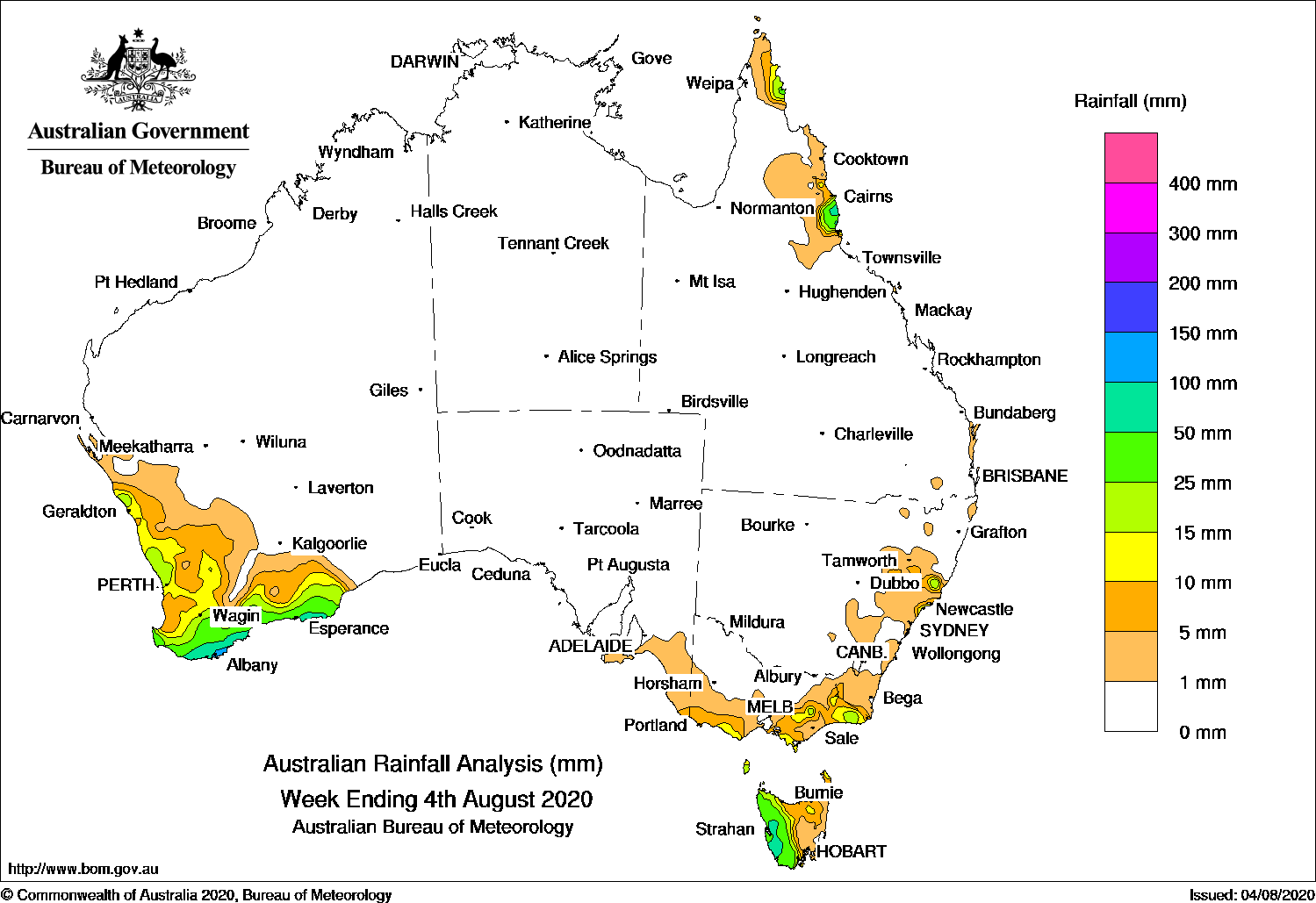
Cold fronts brought moderate falls to southwest Western Australia and western Tasmania,while an onshore flow produced showers and moderate falls about the north tropical coast of Queensland.
Past seven days: At the start of the week, a low pressure system and surface trough slowly moved off the New South Wales coast, and widespread showers eased and contracted to the central to southeast coast of New South Wales, and light to moderate falls were recorded in parts of eastern Victoria.
In the south, a cold front embedded in a westerly airstream tracked over Tasmania, generating moderate falls in western Tasmania. A large high pressure system dominated much of the Australian continent in the middle of the week, with only a few coastal showers reported.
In the second part of the week, the high pressure system was located over the Tasman Sea, and extended a firm ridge along the east coast of Australia. Moist onshore flow produced showers and moderate falls in the north tropical coast and far northern Cape York Peninsula.
A cold front and trough tracked over far southeast Australia, and generated light to moderate falls over western Tasmania, and light falls across that state’s north. A complex area of low pressure and cold front followed and tracked over western Tasmania and southern Victoria. Light to moderate falls were recorded in western Tasmania and along the south coast of Victoria.
At the end of the week, in the west, a low pressure system, cold front and pre-frontal trough moved over southwest and southern Western Australia. Widespread moderate falls were reported over large areas of the South West Land Division, with locally heavier falls reported in the South Coastal and South East Coastal districts in Western Australia.
Rainfall totals in excess of 100 mm were recorded along parts of the South Coastal District in Western Australia, including the highest weekly total of 122 mm at King River.
Rainfall totals in excess of 50 mm were recorded in the South Coastal and South East Coastal districts of Western Australia, an area in western Tasmania and the north tropical coast of Queensland.
Rainfall totals between 10 mm and 50 mm were recorded across large areas of the South West Land Division in Western Australia, western Tasmania, parts of southern and eastern Victoria, pockets of the Hunter District in New South Wales, and in the north tropical coast and far northern Cape York Peninsula of Queensland.
Rainfall totals of less than 10 mm were recorded across remaining parts of the South West Land Division in Western Australia, the eastern half of Tasmania, parts of eastern Victoria and east coast New South Wales, and in the far northeast coast of Queensland.
Highest weekly totals
New South Wales and Australian Capital Territory
23 mm Newcastle University
22 mm Swansea (Catherine St)
21 mm Newcastle (Blacksmiths)
Victoria
23 mm Club Terrace
16 mm Balook
15 mm Multiple locations
Queensland
91 mm Tully Sugar Mill
59 mm Innisfail Aerodrome
51 mm Russell River
Western Australia
122 mm King River
119 mm Tamar
116 mm Mettler
South Australia
6 mm Mount Schank (Jethia)
5 mm ParawaMount Gambier Aero
Tasmania
78 mm Lake Margaret Dam
70 mm Queenstown (South Queenstown)
62 mm Strathgordon Village
Northern Territory
0.6 mm Centre Island
0.4 mm Multiple locations
Mount Read was affected by snow and wind, and the true total is most likely higher.
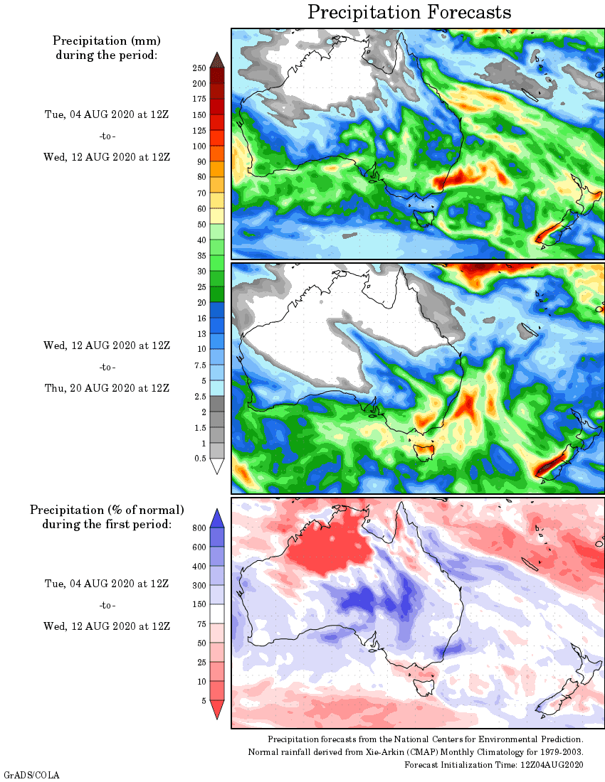
Rainfall outlook


