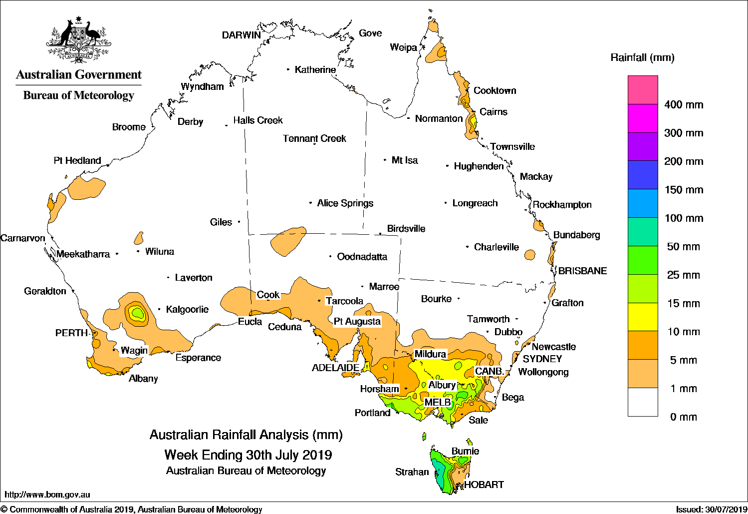
Cold fronts brought moderate rainfall to far southeast Australia at the start of the week, while a cloudband and cold front tracked over the southeast and produced moderate falls in western Tasmania at the end of the week.
Past seven days: In the first part of the week, a cold front moved across the southeast and brought moderate falls to southeast South Australia, southern to northeastern Victoria, parts of the Snowy Mountains in New South Wales, and western and northern Tasmania. A westerly airstream in the wake of the cold front brought further moderate falls to western Tasmania. The next cold front tracked across southern Australia, reaching the southeast by the middle of the week. Light falls were reported in the southwest of Western Australia, parts of coastal South Australia and large parts of Victoria as the front traversed from the west to the east of the continent. In the west, thunderstorms developed over parts of the South West Land Division, and produced isolated moderate falls.
 In the last part of the week, a cloudband associated with a trough extending from central to southeast Australia, brought light falls to southern parts of South Australia, northern Victoria, and southern New South Wales. A cold front tracked northeast across Tasmania at the end of the week, and produced widespread light falls in the southeast, with heavier falls in parts of southern New South Wales.
Onshore flow brought moderate falls to the north tropical coast of Queensland throughout the week, and onshore showers produced light falls along parts of the east and west coasts of Australia.
Rainfall totals in excess of 50 mm were recorded in parts of western and northeastern Tasmania, including the highest weekly total of 103 mm at Queenstown in Tasmania.
Rainfall totals between 10 mm and 50 mm were recorded in the far southwest of Western Australia, southeastern South Australia, southwestern, central and northeastern Victoria, and most of Tasmania except the southeast.
Little or no rainfall was recorded in Western Australia away from the southwest, the Northern Territory, most of Queensland, most of New South Wales away from the south, eastern and northwestern Victoria, South Australia away from the south, and southeastern Tasmania.
Weekly rainfall totals map
Highest weekly totals
New South Wales and Australian Capital Territory
33 mm Thredbo Village
32 mm Perisher Valley AWS
28 mm Rose Bay (Royal Sydney Golf)
Victoria
62 mm Falls Creek (Rocky Valley)
31 mm Falls Creek
27 mm Ferny CreekKinglake WestGrampians (Mount William)
Queensland
35 mm Bingil Bay
22 mm Sunshine Coast Airport
19 mm Cowley Beach (Defence)
Western Australia
22 mm Margaret River
18 mm Walpole Forestry
17 mm Manypeaks
South Australia
25 mm Mount Gambier Aero
23 mm Clarendon, Lake George, Nangwarry Forestry SA Depot
Tasmania
103 mm Queenstown (South Queenstown)
97 mm Lake Margaret Power Station
77 mm Zeehan
Northern Territory
1 mm Centre Island
0.2 mm Multiple locations
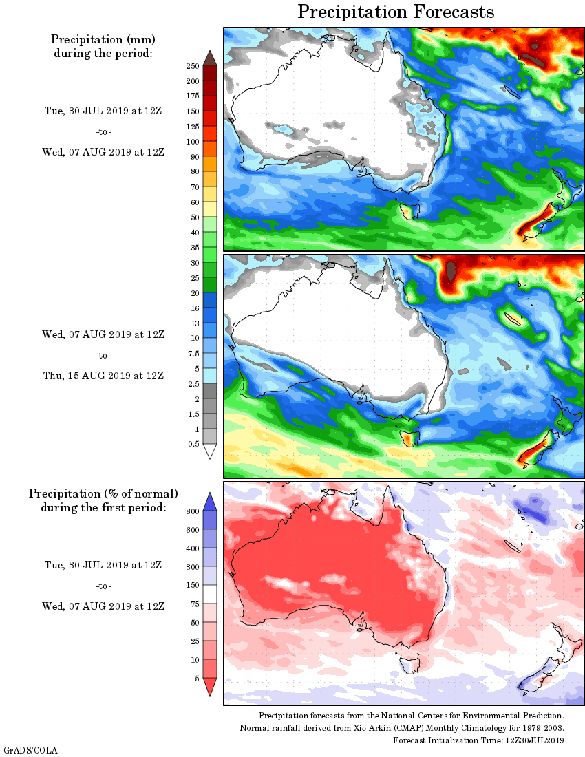
Rainfall outlook: