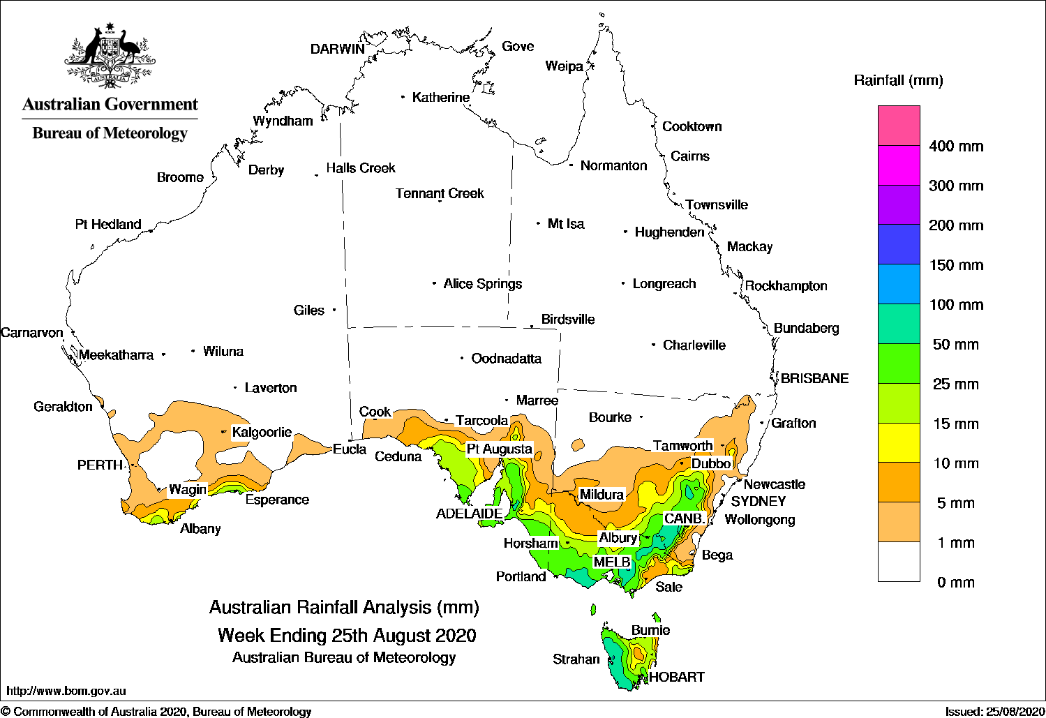
A complex low and cold fronts generated moderate falls over south-east Australia, and widespread snow fell over elevated locations in the south-east.
Past seven days: At the start of the week, a broad complex low extended over the south of the Great Australian Bight and Tasmania, directing a south to south-west airstream over southern Australia, generating widespread light to moderate falls over southern Western Australia, South Australia, Victoria, Tasmania and elevated areas of the Snowy Mountains in New South Wales.
During the middle parts of the week, a strong and fast-moving cold front approached south-east Australia, and the associated complex low in the Bight approached and moved across Tasmania, bringing a cold outbreak to the region, and snow to some elevated areas of the south-east. Widespread falls were recorded over the south-east away from the east coast, with heavier falls in the Snowy Mountains and along the Tablelands of New South Wales, in western and north-eastern Victoria, and western Tasmania.
In the last part of the week, a cold front embedded in an unstable airstream tracked across south-east Australia. The complex low located to Tasmania’s north-east moved slowly into the Tasman Sea, dragging cold and unstable air over eastern Australia. Moderate falls were recorded from southern central to north-eastern Victoria, the Snowy Mountains and Southern Tablelands in New South Wales, and south-east Tasmania.
A cold front and associated cloudband brushed the southern Western Australian coast and adjacent inland areas. A south-westerly flow generated moderate falls over southwest Tasmania and southern Victoria.
Rainfall totals in excess of 100 mm were recorded in parts of western Tasmania and elevated areas of the Victorian Alps. The highest weekly total was 133 mm at Falls Creek (Rocky Valley) in Victoria.
Rainfall totals in excess of 50 mm were recorded in parts of southern and north-eastern Victoria, in the Snowy Mountains and Tablelands in New South Wales, and western Tasmania.
Rainfall totals between 10 mm and 50 mm were recorded in far south-west Western Australia, southern South Australia, most of Victoria except the northwest and parts of East Gippsland, Tasmania, and in southern and along the Tablelands in New South Wales.
Highest weekly totals
New South Wales and Australian Capital Territory
122 mm Mount Ginini AWS
121 mm Perisher Valley AWS
118 mm Argalong (Sandy Creek)
Victoria
133 mm Falls Creek (Rocky Valley)
114 mm Mount Baw Baw
105 mm Wilsons Promontory Lighthouse
Queensland
3 mm Dalveen
1.8 mm Applethorpe
1.6 mm Stanthorpe Leslie Parade
Western Australia
32 mm Esperance
27 mm Cheyne Beach
24 mm Erinair, Oake Marsh Farm
South Australia
87 mm Piccadilly (Woodhouse)
86 mm Aldgate
80 mm LenswoodBridgewater
Tasmania
111 mm Mount Read
103 mm Lake Margaret Dam
89 mm Lake Margaret Power StationZeehan
Northern Territory
0.2 mm Kangaroo Flats (Defence), Hayward Creek (Tipperary)
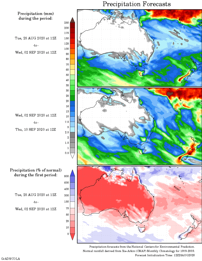
Rainfall outlook