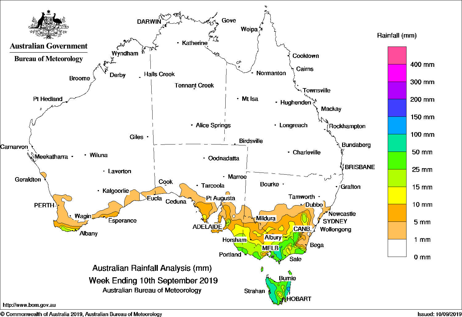
Cold fronts and a transient low on the east coast brought moderate falls to coastal southern Australia and Tasmania, while isolated showers brought moderate falls to parts of the Northern Territory and Kimberley.
Past seven days: At the start of the week a transient low pressure system centred on a coastal trough extending through New South Wales and much of Queensland brought moderate to locally heavy daily rainfall totals to the coast of New South Wales and the southeastern tip of Queensland, with the heaviest falls on the central coast of New South Wales. Meanwhile, in the west an approaching cold front brought light to moderate falls to the coastal southwest of Western Australia.
As the cold front progressed eastward, light to locally moderate falls continued along the south coast of Western Australia and southern South Australia, with light falls widespread over South Australia and western Victoria for the 24 hours to 9 am on the 21st. An associated cloud band with embedded thunderstorms tracked ahead of the front and cellular cloud with isolated storms behind the front. A low pressure centre developed on the line of the front as it crossed Victoria, and then tracked southward across western Tasmania, remaining linked to the tail of the cold front.
During the last part of the week light to moderate falls continued over large parts of Tasmania, Victoria, inland southeastern New South Wales, and parts of agricultural areas of South Australia, in part assisted by a second weak cold front.
Convective cloud formed over parts of the Northern Territory and Kimberley at the end of the week, bringing areas of moderate falls in the eastern Kimberley and the western Alice Springs District.
Moist onshore flow generated some mostly very light falls scattered along the east coast of Queensland during the middle of the week.
Rainfall totals in excess of 50 mm were recorded in parts of central coast New South Wales and the Hunter District, and in small areas reached well over 100 mm for the week, including the highest weekly total of 187 mm at Careys Peak (Barrington Tops).
Rainfall totals of 25 to 50 mm were observed surrounding higher falls along large parts of the central to northern coast in New South Wales, and parts of the coast in southern Western Australia, South Australia, far southwestern Victoria, and in western Tasmania. In many of these areas the highest falls for the week were in the range of 40 to 50 mm.
Rainfall totals between 10 and 25 mm were observed in parts of inland eastern New South Wales, parts of the south coast, parts of the ACT, in the South West Slopes District and extending along the inland side of the ranges in northeastern Victoria to parts of South Gippsland; across much of Victoria’s Western District, the agricultural regions of South Australia and extending to the region around Ceduna and east of Cook; along much of the coast of southern and southwestern Western Australia, areas of the western Alice Springs District in the Northern Territory, and areas along and close to the Northern Territory border in the inland eastern Kimberley District of Western Australia.
Mostly small totals were reported along pockets of the east coast of Queensland, but in some areas of the Brisbane region exceeded 15 mm for the week.
Little or no rainfall was recorded in remaining parts of Western Australia and the Northern Territory, most of Queensland, northern and western South Australia, inland New South Wales, parts of Victoria in coastal East Gippsland and the northwest, and parts of southeast Tasmania.
Highest weekly totals
New South Wales and Australian Capital Territory
187 mm Careys Peak (Barrington Tops)
143 mm Barrington Tops (Mount Barrington)
141 mm Castle Hill (Kathleen Ave)
Victoria
41 mm Cape Nelson Lighthouse
38 mm Portland (Cashmore Airport)
36 mm Mount Baw Baw
Queensland
37 mm Manly Railway Station
20 mm Mt Tamborine Fern St
15 mm Logan City Water Treatment Plant
Western Australia
44 mm Bremer Bay
43 mm Hopetoun
40 mm Denmark
South Australia
51 mm Yeelanna
49 mm Kyancutta, Wudinna Aero
Tasmania
53 mm Mount Read*
40 mm Queenstown (South Queenstown)
24 mm Mount Barrow (South Barrow)MarrawahUpper Esk (South Esk River)
Northern Territory
32 mm Vaughan Springs
21 mm Ormiston Gorge
16 mm Yuendumu
*It is possible that some totals at elevated sites may include snow that fell, but which subsequently melted and was measured on a later day. Alpine sites may also be affected by snow and wind; in such cases the true totals were most likely higher than those reported.
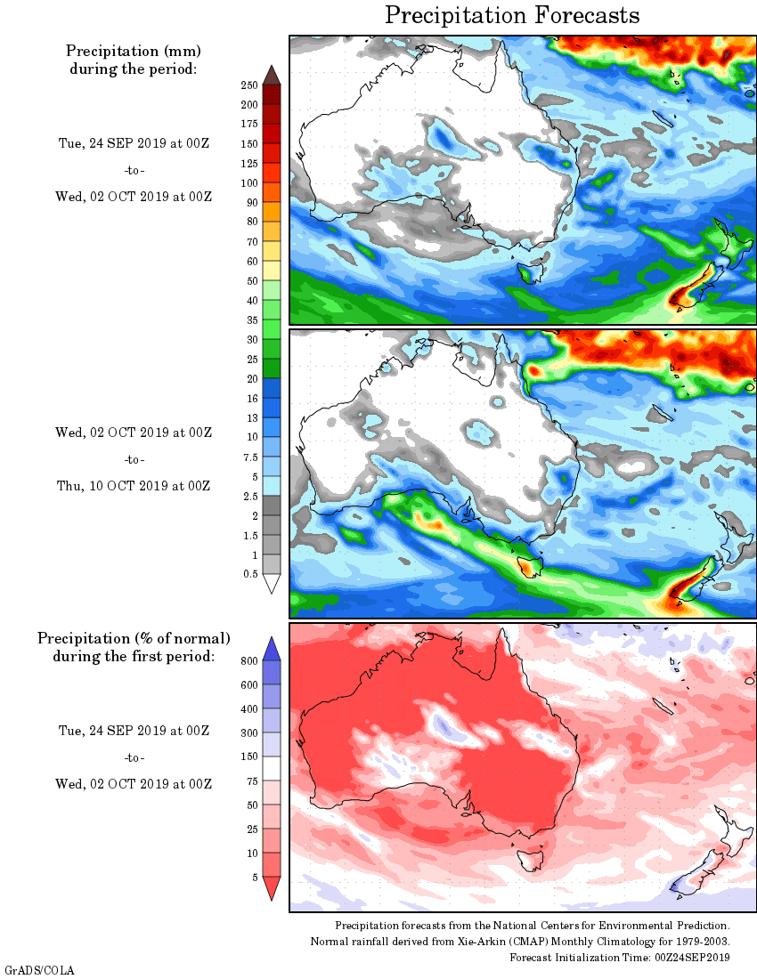
Rainfall outlook: