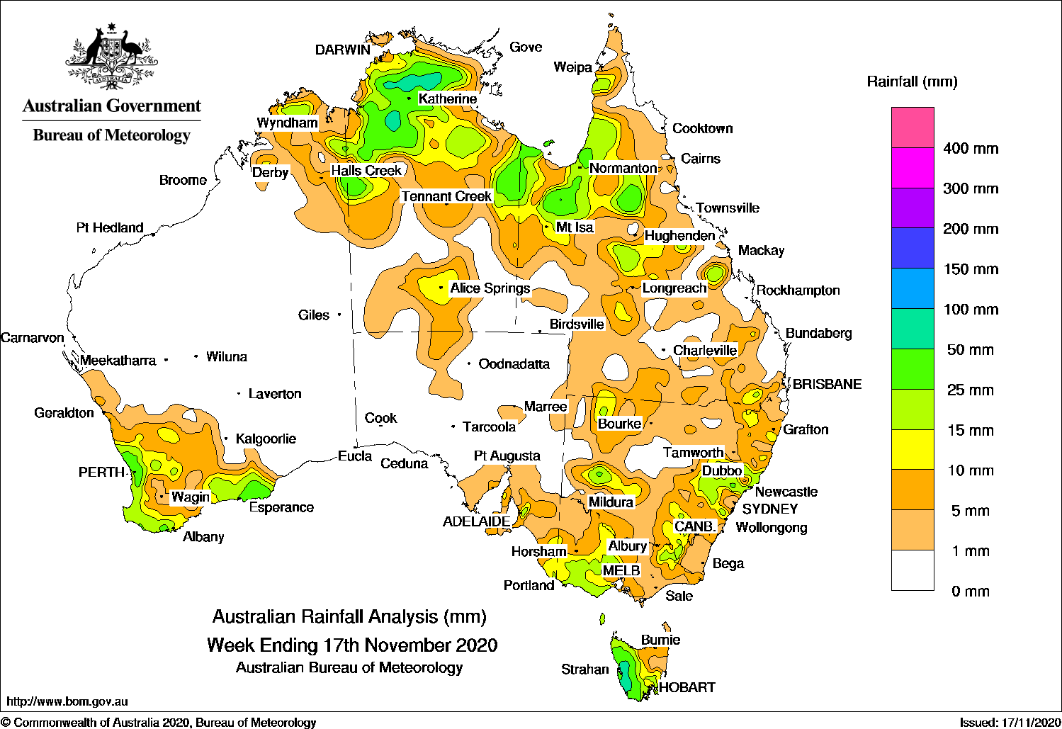
Surface troughs produced thunderstorms across the north and parts of eastern Australia, while cold fronts brought moderate falls to south-west Western Australia and western Tasmania.
Past seven days: At the start of the week, onshore flow in the wake of a cold front produced moderate falls along parts of the south coast of Western Australia. As the cold front moved eastwards through the Bight, and a pre-frontal trough deepened in South Australia, thunderstorms developed along the trough and produced dry lightning and mainly light falls in south-east South Australia. The cold front moved into western Victoria and New South Wales, and the associated trough extending north through western Queensland and across the base of the Top End in the Northern Territory. Moderate falls were reported in north-west Tasmania, across parts of western and north-eastern Victoria, western and central New South Wales, through parts of central western Queensland, about the Gulf Country and across parts of the Top End in the Northern Territory.
During the middle of the week, thunderstorms and showers developed near lingering surface troughs that extended inland along the east coast and around the Top End and into the Kimberley in Western Australia. Moderate falls were reported along parts of the central to north-east coast and adjacent districts in New South Wales, and in area of central and north-west Queensland. Thunderstorms and moderate falls were reported over much of the Top End away from the coast, with heavy falls in some places. A pair of cold fronts tracked the south-west Western Australia, and produced widespread light to moderate falls across much of the South West Land Division.
In the last part of the week, a surface trough through the interior of the continent triggered isolated thunderstorms over southern parts of the Northern Territory and north-west Queensland. A cold front tracked over south-east Australia and a low pressure system moved across Tasmania, and produced moderate falls in western Tasmania.
Highest weekly totals
New South Wales and Australian Capital Territory
45 mm Ivanhoe (Overnewton)
39 mm Murrurundi (Timor)
35 mm Moppy Lookout (Barrington Tops), Milbrodale School, Bulga (Down Town)
Victoria
26 mm Mirranatwa (Bowacka)
25 mm Penshurst (Post Office), Nullawarre
Queensland
47 mm Kamilaroi Station
40 mm Mornington Island Airport
39 mm Robin Hood Station
Western Australia
57 mm Bickley
50 mm The Duke
47 mm Kalumburu
South Australia
32 mm Ashton, Ashton Co-Op
28 mm Uraidla
Tasmania
102 mm Mount Read
75 mm Queenstown (South Queenstown)
68 mm Strathgordon Village
Northern Territory
107 mm Wandie Creek
87 mm Snowdrop Creek
84 mm Old Delamere
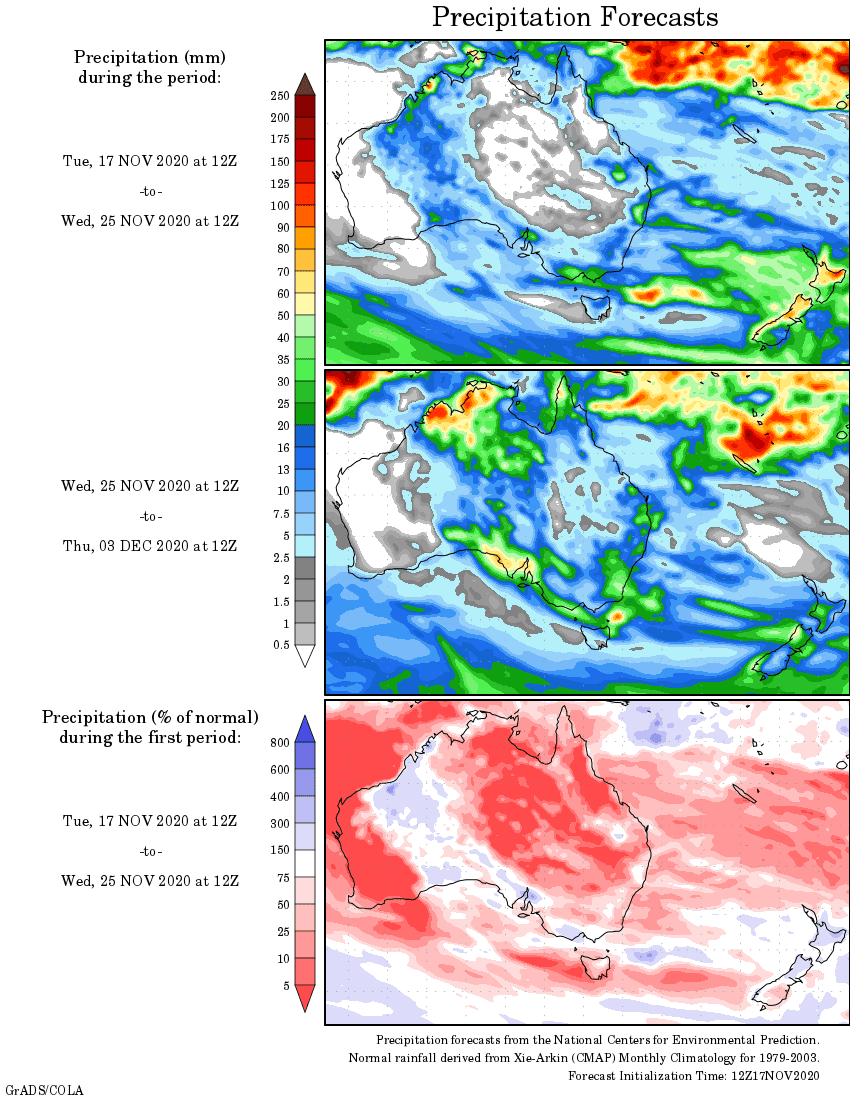
Rainfall outlook