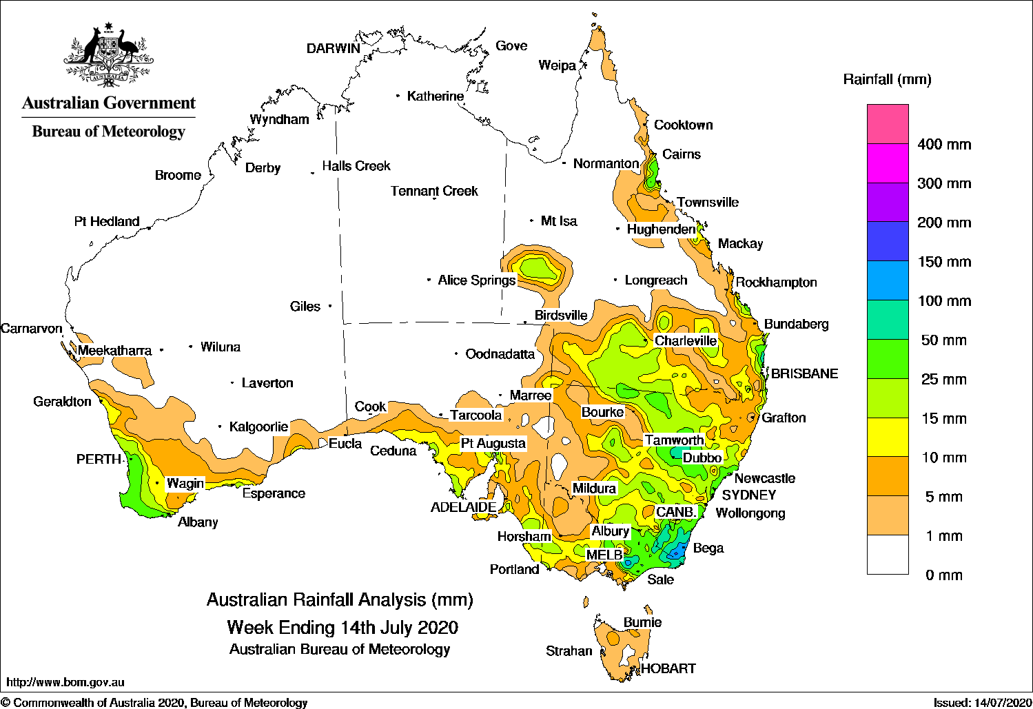
Cold fronts brought moderate falls to southwest Australia, meanwhile a cold front and a complex low produced widespread moderate falls in eastern New South Wales and eastern Victoria.
Past seven days: At the start of the week, a cold front tracked across southwest Western Australia and brought light falls to southwest and southern coastal parts of the State. A high pressure system moved into the Tasman Sea and extended a firm ridge along the east coast. Moist onshore flow produced showers and moderate falls about the northeast coast of New South Wales, and in the north tropical and southeast coasts of Queensland.
At the middle of the week, the cold front tracked over southern and eastern South Australia into Victoria and New South Wales, with a pre-frontal trough stretching from Queensland to New South Wales. Multiple low pressure centres developed across the southeast States in the wake of the cold front. Widespread moderate falls were recorded over southern inland parts of Queensland, northern and central New South Wales, central and northern parts of Victoria and southeastern South Australia.
In the last part of the week, the cold front and low pressure centres moved slowly across New South Wales, with a complex low forming off the east coast. Extensive cloud and embedded thunderstorms preceded the front, and moderate to locally heavier falls were recorded in the South Coast District in New South Wales and parts of eastern Victoria. The moist onshore flow also produced moderate falls along the southeast coast of Queensland.
In the west, a strong cold front and an associated cloudband and embedded thunderstorms moved over southwest Western Australia at the end of the week, and produced moderate falls along the southwest coastal areas, with light falls further inland.
Rainfall totals in excess of 100 mm were recorded in West and East Gippsland in Victoria, and in the South Coast District in New South Wales, including the highest weekly total of 145 mm at both Wapengo Lake Road and Bega (Newtown Road).
Rainfall totals in excess of 50 mm were recorded in areas of central and southeast New South Wales, from central to eastern parts of Victoria, areas along the north tropical and southeast Queensland coasts.
Rainfall totals between 10 mm and 50 mm were recorded in southern Western Australia, southern South Australia, most of Victoria except the far south and northwest, central to eastern New South Wales, and in southern and east coast Queensland.
Highest weekly totals
New South Wales and Australian Capital Territory
145 mm Wapengo Lake RoadBega (Newtown Road)
141 mm Black Range (Grandview Lane)
Victoria
96 mm Mount Baw Baw
80 mm Briagolong
76 mm Combienbar AWS
Queensland
84 mm Caloundra Airport
62 mm Nambour DAFF – Hillside
61 mm Tewantin RSL Park
Western Australia
55 mm Mount Solus
52 mm Huntly
51 mm Cowaramup, Witchcliffe, Barrett, Meadows
South Australia
28 mm Myponga
26 mm Ashton Co-Op, Keith (Munkora), Keith
Tasmania
12 mm Mount Victoria (Una Plain)
11 mm Lake Margaret Power Station
9 mm Pipers River (Bay Of Fires)
Northern Territory
0.6 mm Centre Island
0.4 mm Gove Airport
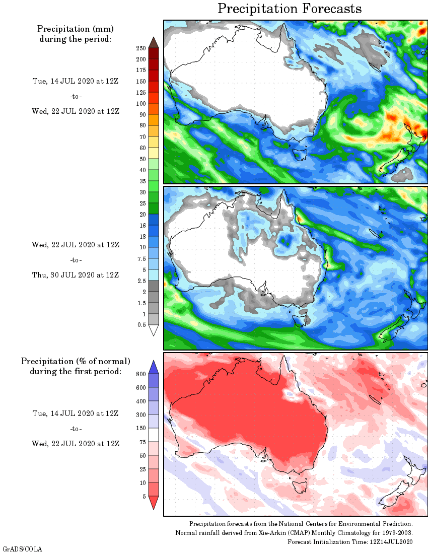
Rainfall outlook