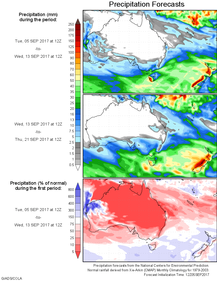
For today’s 14-day rainfall outlook – scroll to bottom of article
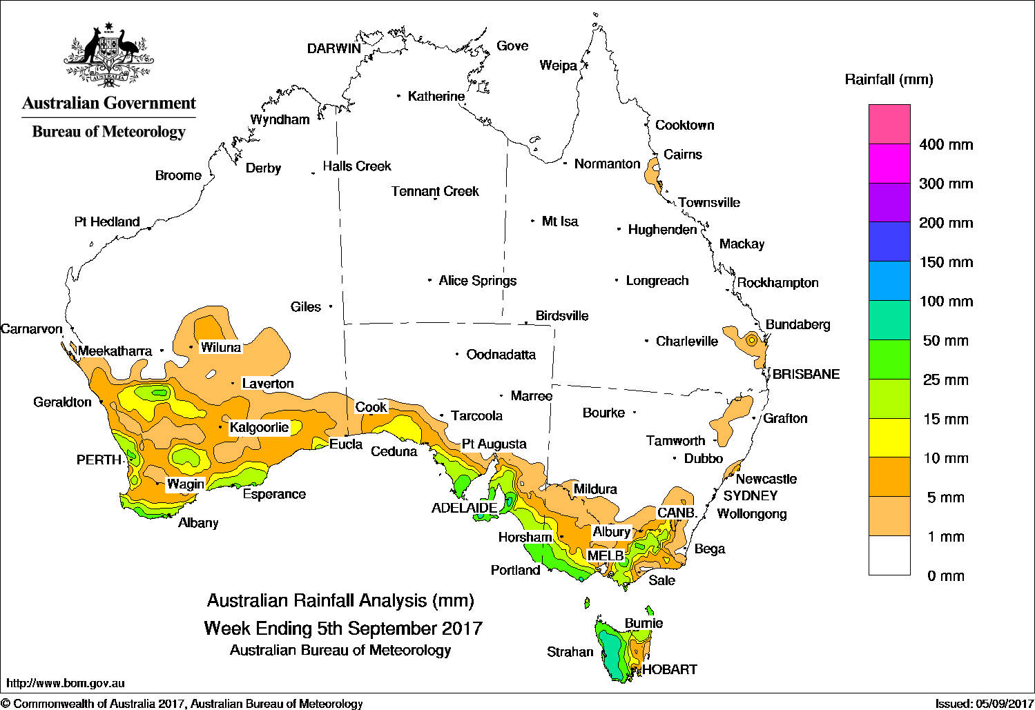
A surface trough with thunderstorms produced moderate falls in the South West Land Division. A series of vigorous cold fronts produced moderate falls in southeastern Australia.
Past seven days: At the start of the week, a deep surface trough and associated thunderstorms produced light to moderate falls in the Gascoyne district, South West Land Division and southern interior of Western Australia. In the southeast, a cold front tracked across Tasmania and Victoria, with moderate falls recorded in western Tasmania and light falls for remaining parts of the State.
Around the middle of the week, a weak cold front tracked across southwest Western Australia, producing a cloudband and moderate falls for parts of the west coast in southwest Western Australia. An upper-level trough produced a cloudband and isolated embedded thunderstorms, with moderate falls recorded over southeast Western Australia and western South Australia.
At the end of the week, interaction between the upper-level trough and cold front generated an extensive cloudband with further embedded thunderstorms over the southeastern parts of the continent. Moderate falls were recorded along the southern coast of South Australia, southern Victoria, and in western and northern Tasmania as well as in elevated areas of northeastern Victoria and the Snowy Mountains in New South Wales.
Isolated showers produced light falls in pockets of northeast and southeast Queensland and parts of northeastern New South Wales.
Rainfall totals exceeding 50 mm were recorded in western Tasmania, the Mount Lofty Ranges in South Australia and in elevated areas of the Victorian Alps. The highest weekly total was 97 mm at Piccadilly in the Mount Lofty Ranges in South Australia.
Rainfall totals between 10 mm and 50 mm were recorded in areas of southern Western Australia including its southern coast; southern coastal areas of South Australia; in Victoria’s southwest, central and northeastern districts; the Snowy Mountains in New South Wales, and in western and northern Tasmania.
Little or no rainfall was recorded in central and northern Western Australia, the agricultural districts in South Australia, the Northern Territory, Queensland, and most of New South Wales except about the Snowy Mountains.
Highest weekly totals
New South Wales and Australian Capital Territory
28 mm Perisher Valley AWS
23 mm Thredbo Village
15 mm Smiths Lake (Patsys Flat Road)
Victoria
91 mm Falls Creek (Rocky Valley)
67 mm Wilsons Promontory Lighthouse
55 mm Apollo Bay
Queensland
14 mm Cape Moreton Lighthouse
7 mm Gairloch
6 mm Gympie
Western Australia
36 mm Pemberton
34 mm Minston Park
33 mm Karri Valley Resort
South Australia
97 mm Piccadilly (Woodhouse)
81 mm Heathfield Works Depot
76 mm Uraidla
Tasmania
72 mm Queenstown (South Queenstown)
65 mm Lake St Clair National Park
64 mm Mount Read*
Northern Territory
0.6 mm Centre Island
0.2 mm Darwin Airport
More weekly rainfall totals:
- NSW/ACT totals click here
- Vic totals click here
- Qld totals click here
- WA totals click here
- SA totals click here
- Tas totals click here
- NT totals click here
Source: BOM