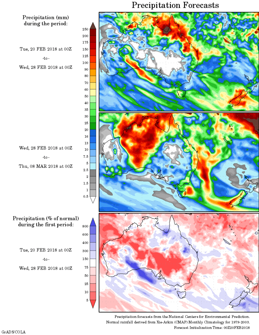
For today’s 14-day rainfall outlook – scroll to bottom of article
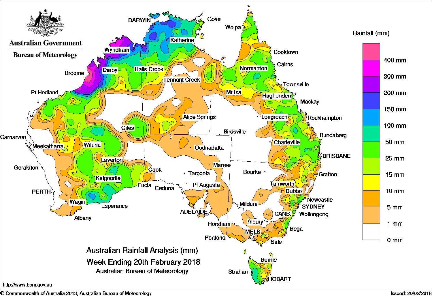
Tropical cyclone Kelvin made landfall between Broome and Port Hedland in Western Australia on 18 February, and brought very heavy rainfall to the western Kimberley. Broad areas of low pressure across western, northern and eastern Australia produced showers and storms.
The highest weekly total was 576 mm at West Roebuck in the west Kimberley in Western Australia
Past seven days: At the beginning of the week, a surface trough over northern Western Australia and the Northern Territory’s Top End, with a weak tropical low forming in the far north of the Northern Territory, triggered showers and storms across these districts, producing moderate to locally heavy falls. Another surface trough located through inland Queensland triggered thunderstorms in the northern interior of Queensland, and about the State’s southeast coast. In the south, a cold front swept across Tasmania and produced a strong and gusty westerly flow, and brought moderate falls to western Tasmania.
By the middle of the week, the tropical low moved across the Top End and inland Kimberley. Moderate to heavy falls were reported across much of the western Kimberley, with moderate falls across the Top End in the Northern Territory and coastal Kimberley. Broome recorded 370.6 mm to 9am on the 17th, more than half the annual average rainfall. The low intensified further once over the water near the west Kimberley coast and was named tropical cyclone Kelvin on the afternoon of the 17th before making landfall on the morning of the 18th near Anna Plains in the far west Kimberley. Kelvin weakened to an ex-tropical cyclone on the 19th as it tracked across the Northern Interior district of Western Australia, with further moderate falls reported from the Goldfields District to the south coast of Western Australia.
A surface trough inland from the west coast of Western Australia brought moderate falls to the State’s south coast over several days from mid-week, and also produced showers and thunderstorms with moderate falls in the Pilbara. Another surface trough extending from the northwest to the southern interior of Queensland in the middle of the week produced showers and storms with moderate falls reported along the State’s east coast south of Cairns. Further moderate falls associated with showers and thunderstorms were reported in northern Queensland.
At the end of the week, a significant upper-level trough over southern inland Queensland strengthened into an upper level low, and combined with a surface trough over southern Queensland and northern New South Wales. These features produced widespread, moderate falls between Queensland’s Central Highlands and the Darling Downs, and in eastern New South Wales.
Rainfall totals exceeding 400 mm were recorded in parts of the West Kimberley district in Western Australia, including the highest weekly total of 576 mm at West Roebuck, while totals greater than 200 mm were recorded along the north and west Kimberley coasts.
Rainfall totals between 100 mm and 200 mm were recorded in the northwest Top End of the Northern Territory and surrounding higher falls in the Kimberley in Western Australia.
Rainfall totals in excess of 50 mm were recorded in the northeastern Kimberley and across much of the Top End of the Northern Territory, as well as surrounding higher falls. Similar totals were observed on the central southern coast of Western Australia, in isolated pockets in the east of Queensland and New South Wales, and across much of western Tasmania.
Rainfall totals between 10 mm 50 mm were recorded in the Kimberley, Pilbara, central inland and southern districts of Western Australia away from the west coast; in the northwest and far south of the Northern Territory; across northern and eastern Queensland; eastern New South Wales; a small area of far eastern and southern central Victoria, and in western, central and northeastern Tasmania.
Little or no rainfall was recorded along the west coast eastern interior of Western Australia, the majority of South Australia, most of Victoria away from the south and east, central and western New South Wales, and the southwest quarter of Queensland.
Highest weekly totals
New South Wales and Australian Capital Territory
71 mm Moruya Airport AWS
67 mm Wyong (Jilliby Creek)
64 mm Wyong (Jeavons)
Victoria
47 mm Reeves Knob
37 mm Murderers Hill
24 mm Mount Wellington, Mount Moornapa
Queensland
89 mm Georgetown Airport
85 mm Yarraman Post Office, Somerset Dam
Western Australia
576 mm West Roebuck
498 mm Broome Airport
392 mm Bidyadanga
South Australia
11 mm Arno Bay
10 mm Cummins Aero
9 mm Multiple locations
Tasmania
136 mm Mount Read
98 mm Queenstown (South Queenstown)
97 mm Tim Shea (Summit)
Northern Territory
234 mm Csiro Berrimah
223 mm Nitmiluk Rangers
217 mm Dum In Mirrie Airstrip