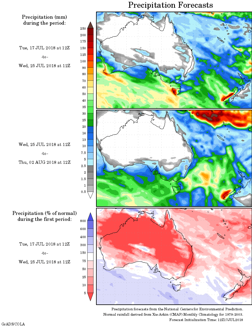
For today’s 14-day rainfall outlook – scroll to bottom of article
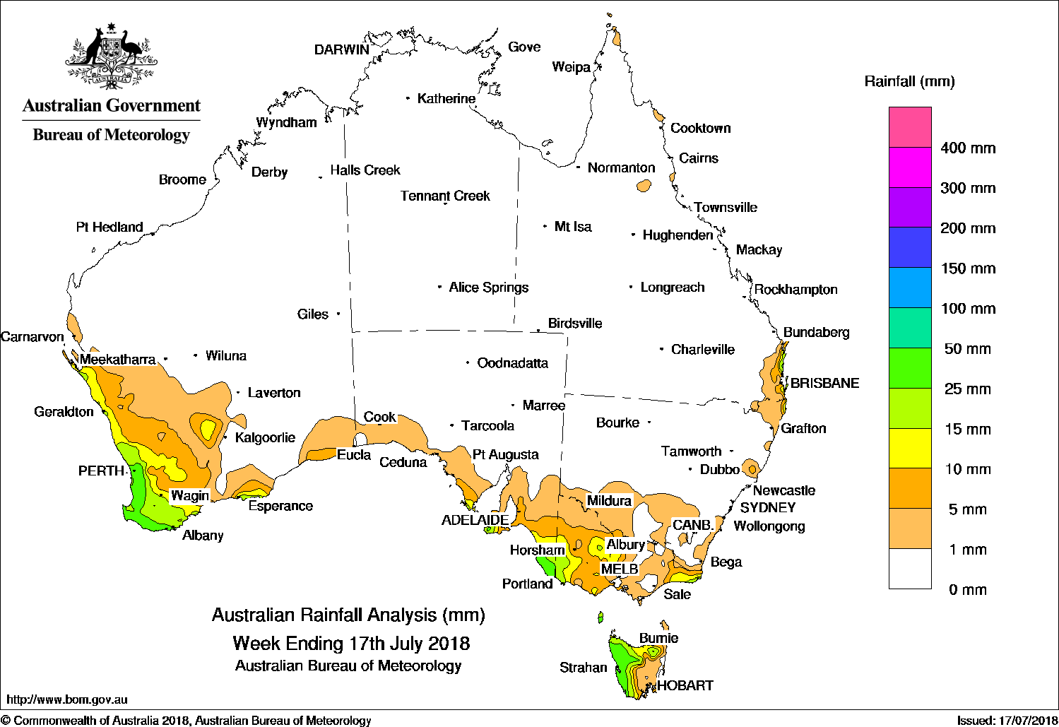
A weak low pressure system over Victoria produced moderate falls in southeastern South Australia and western Victoria, while a series of cold fronts tracked across the south, generating moderate falls along the South West Land Division in Western Australia, and in western and northern Tasmania.
Past seven days: At the start of the week, a weak low pressure system and a cold front tracked over southeastern South Australia and western Victoria to produce moderate falls in these regions. The low then moved over eastern Victoria and generated showers and moderate falls in East Gippsland. Showers and moderate falls were recorded about the southeastern Queensland coast, due to an onshore southeasterly airflow.
In the middle of the week, a weak cold front tracked across southwest Western Australia. The system produced mainly light falls along the southwest coast., while the remainder of the country was mostly clear.
Towards the end of the week, a pair or cold fronts embedded in a vigorous westerly flow tracked over southern Western Australia, led by a thick cloudband. Showers were reported in the southern Gascoyne, the South West Land Division, and southern Goldfields areas with moderate falls in the southwest coast. As the cold fronts tracked eastwards, mostly light falls were recorded along the southeast coast of Western Australia and the exposed southern coast of South Australia. Heavier falls were recorded in western and northern Tasmania.
Rainfall totals in excess of 50 mm were recorded in isolated areas in southeast Queensland and the far southwest coast of Western Australia. The highest weekly total was 95 mm at Cape Moreton Lighthouse in Queensland.
Rainfall totals between 25 mm and 50 mm were recorded in western Tasmania, most of the Lower West and South West districts in Western Australia, a small area in southeastern South Australia, and a pocket of the southeast coast of Queensland.
Rainfall totals between 10 mm and 25 mm were recorded in the southern Gascoyne coast, much of the South West Land Division, and southern Goldfields in Western Australia; southeastern South Australia including Kangaroo Island; far southwestern, northern central and far eastern Victoria; western and much of northern Tasmania; and a small area of northeastern New South Wales and the southeastern Queensland coast.
Little or no rainfall was recorded in remaining parts of Western Australia, the Northern Territory, South Australia away from the southeast coast, central and northwestern Victoria, eastern Tasmania, most of New South Wales and most of Queensland.
Highest weekly totals list and map
New South Wales and Australian Capital Territory
36 mm Byron Bay (Cape Byron AWS)
23 mm Mullumbimby (Fairview Farm)
20 mm Mount George (Manning River)
Victoria
32 mm Point Hicks (Lighthouse)
24 mm Cape Nelson Lighthouse
21 mm Gabo Island Lighthouse
Queensland
95 mm Cape Moreton Lighthouse
62 mm Sunshine Coast Airport
41 mm Lady Elliot Island
Western Australia
61 mm Mount William
60 mm Walpole ForestryKarragullen North
South Australia
37 mm Lake George
36 mm Kalangadoo
31 mm Mount Gambier Aero
Tasmania
83 mm Mount Read
40 mm Zeehan
39 mm Mount Barrow (South Barrow), Strahan Aerodrome
More weekly rainfall totals:
- NSW/ACT totals click here
- Vic totals click here
- Qld totals click here
- WA totals click here
- SA totals click here
- Tas totals click here
- NT totals click here
Source: BOM
Rainfall outlook: