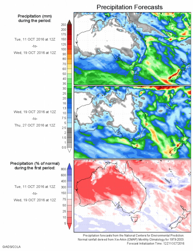
Today’s 14-day rainfall outlook – scroll to bottom of article
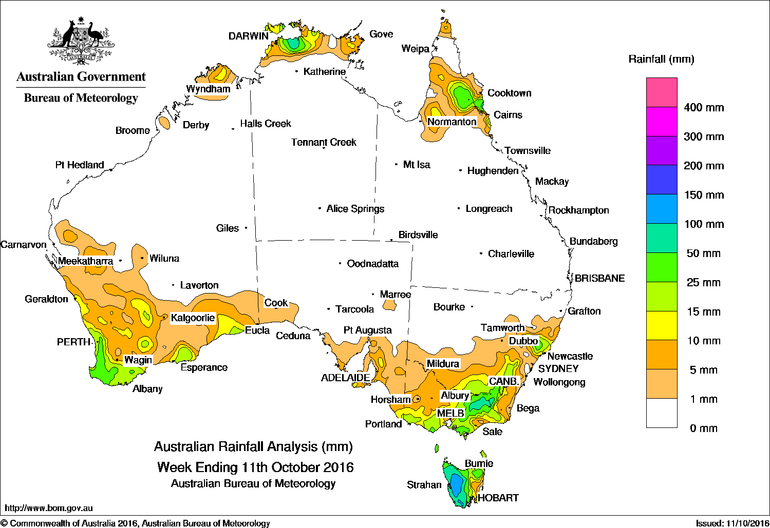
Past seven days: At the start of the week, a cold front embedded in a cold westerly airstream tracked across southeast Australia. The system produced moderate falls in northeastern Victoria, parts of the Snowy Mountains in New South Wales and western Tasmania. Widespread light falls were reported across large areas of Victoria and southern New South Wales.
Meanwhile, a surface trough extending across the far northern tropics generated thunderstorms with moderate rainfall totals recorded about the northern Top End and Cape York Peninsula.
During the middle of the week, two weak cold fronts tracked across southern Australia and an associated middle level cloudband produced light to moderate falls in southern and southwest Western Australia and western Tasmania.
Towards the end of the week the second of these cold fronts crossed Tasmania and the southeast, having strengthened as the associated low deepened. This strong frontal system brought damaging winds to large areas, while moderate falls were recorded in western Tasmania, the Victorian Alps, and the central coast of New South Wales. Lighter falls were reported throughout areas of the southern coast of Australia, across southern Victoria and southern New South Wales.
50-100mm: Northern parts of the Darwin–Daly district in the Top End of the Northern Territory, the Victorian Alps, the Snowy Mountains in New South Wales, and across nearly all of western Tasmania. Isolated falls exceeding 100 mm were recorded in parts of central western Tasmania, including the highest weekly total of 149 mm at Mount Read.
10-50mm: Northern Top End, the Cape York Peninsula in Queensland, southwest and southern Western Australia, most of Victoria except the northwest, eastern and southern New South Wales, and most of the remainder of Tasmania.
Little or no rainfall: Central and northern Western Australia, most of the Northern Territory away from the northern Top End, most of South Australia away from southern parts of the agricultural areas, large parts of Queensland except the north, and northern and central New South Wales.
Highest weekly totals list and map
New South Wales and Australian Capital Territory
98 mm Perisher Valley AWS
95 mm Thredbo Village
52 mm Careys Peak (Barrington Tops)
Victoria
111 mm Falls Creek (Rocky Valley)
68 mm Mount Buller
65 mm Ovens River
Queensland
128 mm Mossman South Alchera Drive
80 mm Low Isles Lighthouse
43 mm Reef Park
Western Australia
48 mm Huntly
47 mm Ferguson Valley, Donnybrook
South Australia
21 mm Williamstown
19 mm Parawa
18 mm Tarlee
Tasmania
149 mm Mount Read
147 mm Lake St Clair National Park
129 mm Lake Margaret Power Station
Northern Territory
86 mm Point Stuart
36 mm Middle Point Rangers
34 mm Jabiru Airport
More weekly rainfall totals:
- NSW/ACT totals click here
- Vic totals click here
- Qld totals click here
- WA totals click here
- SA totals click here
- Tas totals click here
- NT totals click here
Source: BOM