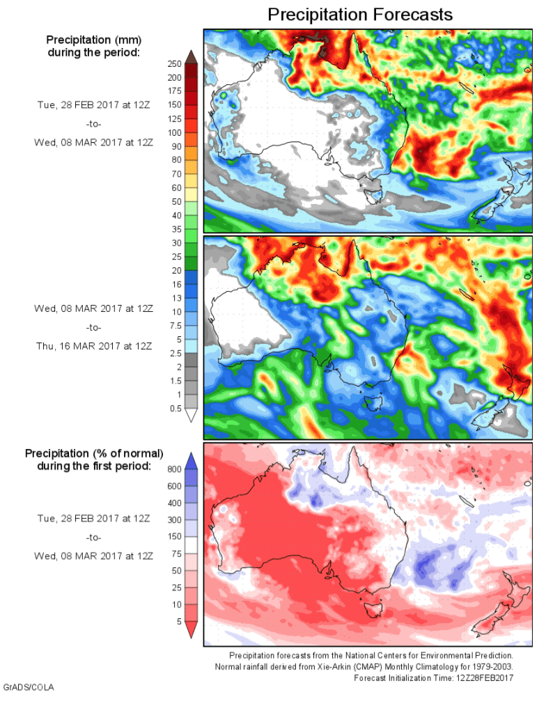
Today’s 14-day rainfall outlook – scroll to bottom of article
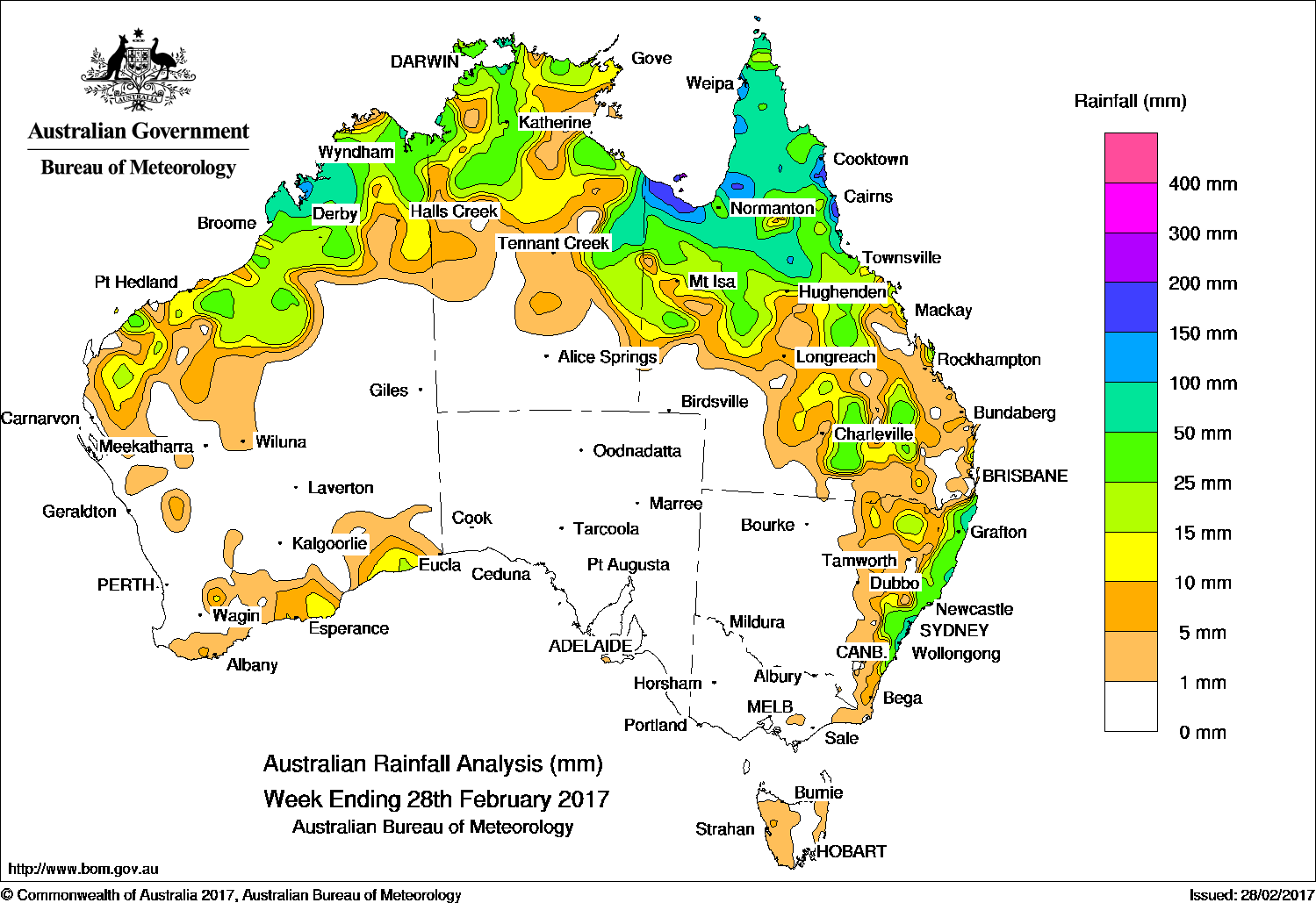
Rainfall during the past week was recorded in the northwest and along the south coast of Western Australia, the northern half of the Northern Territory, northern and eastern Queensland and eastern New South Wales.
At the start of the week, ex-tropical cyclone Alfred was embedded on a low pressure surface trough that extended across northern Australia. The remnants of Alfred produced moderate to heavy falls in northern Queensland from the Gulf Country and Cape York Peninsula to the north tropical coast. In the west, a weak cold front brushed the southern coast of Western Australia, producing mostly light falls along the coastline.
From the middle of the week, thunderstorms and showers formed over northern Australia, with moderate falls recorded along the Northern Territory–Queensland border, and the Cape York Peninsula and north tropical coast around Innisfail. Showers and thunderstorms also formed in the vicinity of a surface trough extending across the Top End and northwest Australia. Moderate to heavy rainfall totals recorded in areas of the Kimberley and Pilbara in Western Australia, the Top End in the Northern Territory and northern Queensland.
In the latter part of the week, widespread showers and thunderstorms developed over northeastern and eastern New South Wales, and Queensland’s southern interior and parts of the southeast. The convective activity resulted in moderate falls recorded along the east coast of New South Wales, and across large areas of the inland southern Queensland.
Rainfall totals in excess of 200 mm were recorded in the north tropical coast in Queensland , including the highest weekly total of 262 mm at Mt Sophia.
Rainfall totals between 100 mm and 200 mm were recorded in parts of the Gulf Country, western Cape York Peninsula and northern tropics in Queensland.
Rainfall totals between 50 mm and 100 mm were recorded in the Kimberley and Pilbara; in the northwest Top End in the Northern Territory; parts of the Gulf Country and much of Cape York Peninsula, the northern interior of Queensland and pockets along the east coast of New South Wales.
Rainfall totals between 10 mm and 50 mm were recorded in much of the Kimberley, Pilbara and western Gascoyne districts, and south coast in Western Australia; large areas of the Top End and eastern parts of the Northern Territory; northern and parts of eastern Queensland, and northeastern and east coast New South Wales.
Little or no rainfall was recorded in the southern half of Western Australia away from the south coast; South Australia; Victoria; Tasmania; western and central New South Wales; southwestern Queensland and the southern half of the Northern Territory.
Highest weekly totals
New South Wales and Australian Capital Territory
169 mm Evans Head RAAF
136 mm Mona Vale Golf Club
132 mm Woodburn (Cedar St)
Victoria
7 mm Reeves Knob
4 mm Orbost, Murderers Hill
Queensland
262 mm Mt Sophia
255 mm Russell River
243 mm Innisfail
Western Australia
96 mm Mount House Airstrip
91 mm Warrawagine
90 mm Derby Main Roads
South Australia
2 mm Flinders Chase (Rocky River)
1.4 mm Minburra
0.8 mm Hindmarsh Island AWS
Tasmania
16 mm Mount Read
8 mm:
Pyengana (Forest Lodge Road)
Lake Margaret Power Station
Golden Valley (Brodies Road)
Northern Territory
87 mm Darwin Airport
72 mm Upper Seventeen Mile Creek
63 mm Croker Island Airport
More weekly rainfall totals:
- NSW/ACT totals click here
- Vic totals click here
- Qld totals click here
- WA totals click here
- SA totals click here
- Tas totals click here
- NT totals click here
Source: BOM