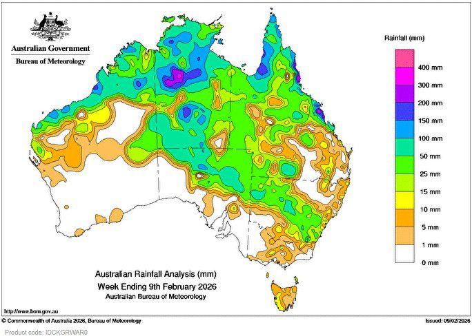
SEVERE Tropical Cyclone Mitchell (21U) brought widespread rain, showers and thunderstorms to large parts of north-western Australia, as the system pulled in deep tropical moisture and generated unstable air.
As a tropical low, moist air from 21U was drawn south-eastwards across central and south-eastern Australia by inland troughs, resulting in widespread rain, showers and thunderstorms.
Weekly rainfall totals of 50 to 150 mm, with isolated heavier falls, were recorded along Queensland’s central and north tropical coasts, the Cape York Peninsula, much of the Northern Territory, and in a band stretching from the north of Western Australia, through northern parts of South Australia into central New South Wales.
Weekly rainfall totals of 25 to 50 mm were recorded over most of the rest of northern Australia.
A cold front and associated trough passed over Tasmania bringing light to moderate showers.
Weekly rainfall totals of 10 to 25 mm were recorded across parts of western Tasmania.
The highest weekly total (at a Bureau gauge) was 374.0 mm at Menavale Alert in Queensland, which included the highest daily total of 181.0 mm in the 24 hours to 9 am on 7 February.