Low pressure troughs brought widespread showers and isolated thunderstorms, with locally high rainfall rates in north-eastern New South Wales and south-eastern and central Queensland between 26 October and 1 November.
A cold front crossed south-west Western Australia on 31 October bringing light rain, before interacting with moist tropical air over the Nullarbor on 1 November while moving towards south-eastern Australia, triggering thunderstorm activity and widespread rain to the south-east.
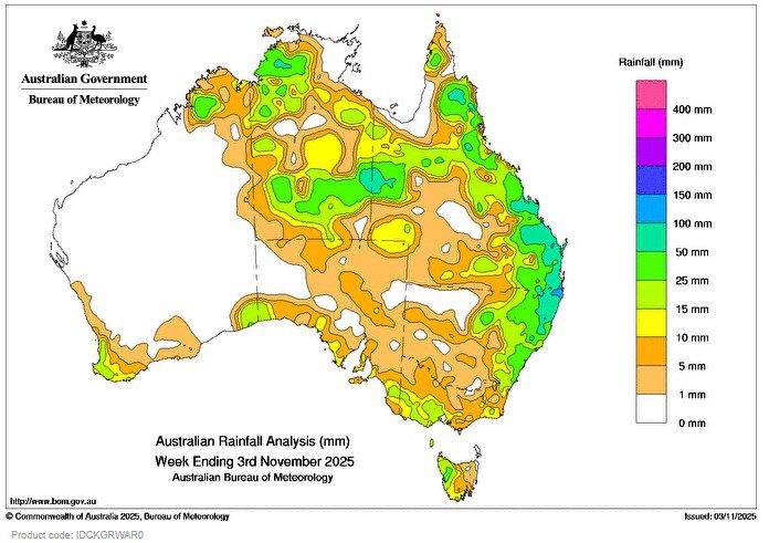
Much of eastern Australia received at least 5 mm during the week.
Weekly totals of 10–25 mm for south-west Western Australia, much of Victoria and western Tasmania from frontal systems.
Weekly totals of 25–50 mm, locally higher, from storms across tropical north Queensland, the Top End of the Northern Territory, Western Australia’s Kimberley and Eucla districts, and coastal New South Wales.
Weekly totals of 50–100 mm, locally higher, from severe storms in south-east Queensland and north-east New South Wales.
The highest weekly total (at a Bureau gauge) was 254.0 mm at Brays Creek (Misty Mountain), NSW, and the highest daily total was 119.4 mm at Rosebank (Upper Coopers Creek) (NSW), in the 24 hours to 9 am on 29 October.