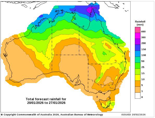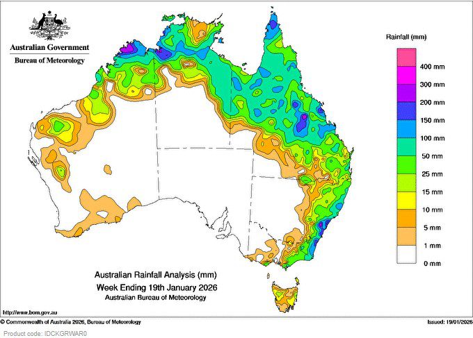
Widespread rain, showers and thunderstorms impacted parts of the tropical north throughout the week, driven by deepening monsoonal flow and the development of troughs and low pressure systems.
Ex-tropical cyclone Koji tracked across northern Queensland, producing widespread heavy rainfall and embedded storms. Minor to major flooding continues across large parts of Queensland.
Weekly rainfall totals of 50 to 300 mm, and locally higher, were recorded across much of tropical and eastern Queensland, the Top End and eastern parts of the Northern Territory and northern regions of Western Australia.
A coastal low pressure trough off the south coast of New South Wales and an upper trough, triggered moderate to heavy rainfall and thunderstorms, some severe, in eastern parts of New South Wales and eastern Victoria, leading to flash flooding.
Weekly rainfall totals of 50 to 200 mm, and locally higher, were recorded across eastern parts of New South Wales and south-eastern Queensland.
A deepening low pressure system interacting with a moist east to south-easterly flow, generated slow moving showers, heavy to intense rainfall and thunderstorms, some severe, in Victoria over Gippsland, the Otways and Wilson’s Promontory, leading to flash flooding.
Weekly rainfall totals of 25 to 100 mm, and locally higher, were recorded across southern and eastern parts of Victoria.
The highest weekly total (at a Bureau gauge) was 370.2 mm at Beaumont (The Cedars) in New South Wales.
The highest daily total (at a Bureau gauge) was 259.0 mm at Wattamolla (Griffiths) in New South Wales in the 24 hours to 9 am on 18 January.