SEVERE tropical cyclone Kirrily made landfall on the north Queensland coast as a Category 2 system on the evening of 25 January between Townsville and Ingham, before being downgraded to a tropical low as it moved south-west towards inland Queensland.
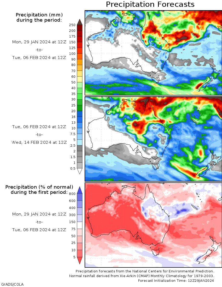
Ex-tropical cyclone Kirrily remained slow moving over Queensland, feeding tropical moisture across central and south-eastern areas of the state and north-eastern New South Wales, bringing heavy rain and thunderstorms.
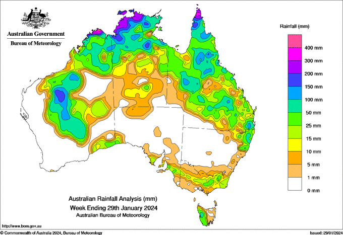
Monsoonal conditions continued to impact the tropical north during the week and brought days of heavy rainfall and flooding to the Northern Territory, Queensland and Western Australia.
Weekly rainfall totals between 50 to 100 mm were recorded in areas across Queensland, north-eastern New South Wales, northern areas of the Northern Territory, north-western and central parts of Western Australia and western Tasmania.
Weekly rainfall totals between 100 to 200 mm were recorded in isolated pockets of central, western and northern Queensland, the Top End of the Northern Territory including small pockets in western and eastern areas, and north-western and central parts of Western Australia.
Weekly rainfall totals greater than 200 mm were recorded along some coastal areas of the northern tropics.
The highest weekly rainfall total at a Bureau rain gauge was 391.6 mm at Kalumburu (Western Australia), which also recorded the highest daily rainfall of 182.4 mm in the 24 hours to 9 am on 23 January.


