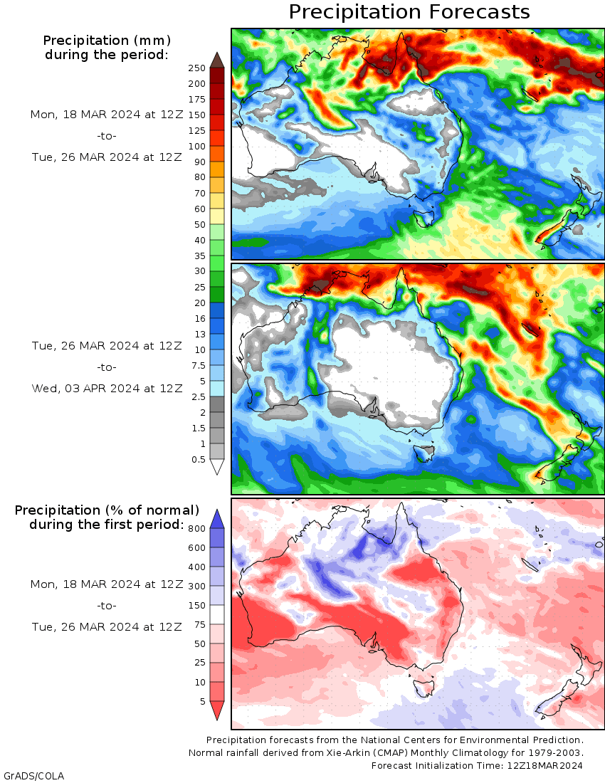
A MONSOON trough that redeveloped across the Top End of the Northern Territory and far north Queensland, and Tropical Cyclone Megan brought heavy rain, widespread showers and thunderstorms to northern Australia.
During the first half of the week, a near-stationary low pressure trough across central and south-eastern Western Australia interacted with tropical moisture advected from the Timor Sea, resulting in frequent showers, heavy rain and thunderstorms.
At the end of the week, an inland low pressure trough brought high humidity, showers and thunderstorms to inland New South Wales, eastern South Australia and north-western Victoria.
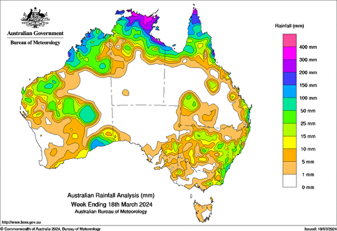
Rainfall totals greater than 100 mm were recorded in parts of the Top End and northern Queensland, with some areas receiving more than 200 mm for the week. Rainfall totals greater than 100 mm were also recorded in parts of Western Australia’s Kimberley and Eucla districts.
Areas of northern, central and south-eastern Western Australia, the Top End and northern Queensland recorded weekly totals between 50 and 100 mm, while pockets of coastal south-eastern Queensland and New South Wales received between 25 and 50 mm for the week.
The highest weekly total (at a Bureau gauge) was 767.6 mm at Groote Eylandt Airport (NT), including the highest daily rainfall total of 431.0 mm in the 24 hours to 9 am on 17 March.