November to January 2020 rainfall outlook
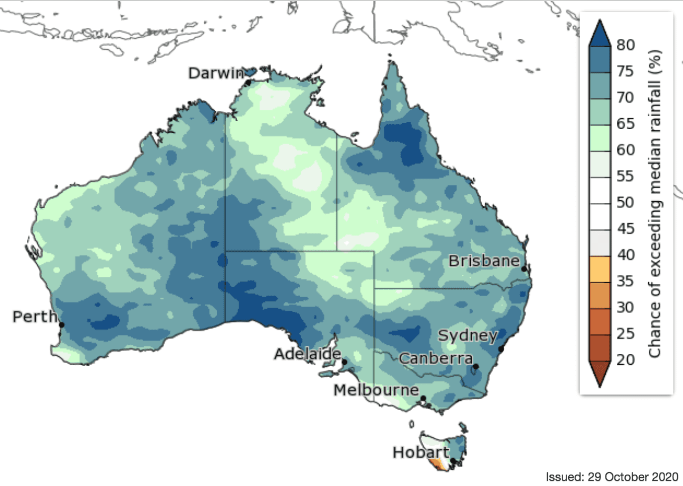
November to January wetter than average for nearly all of Australia
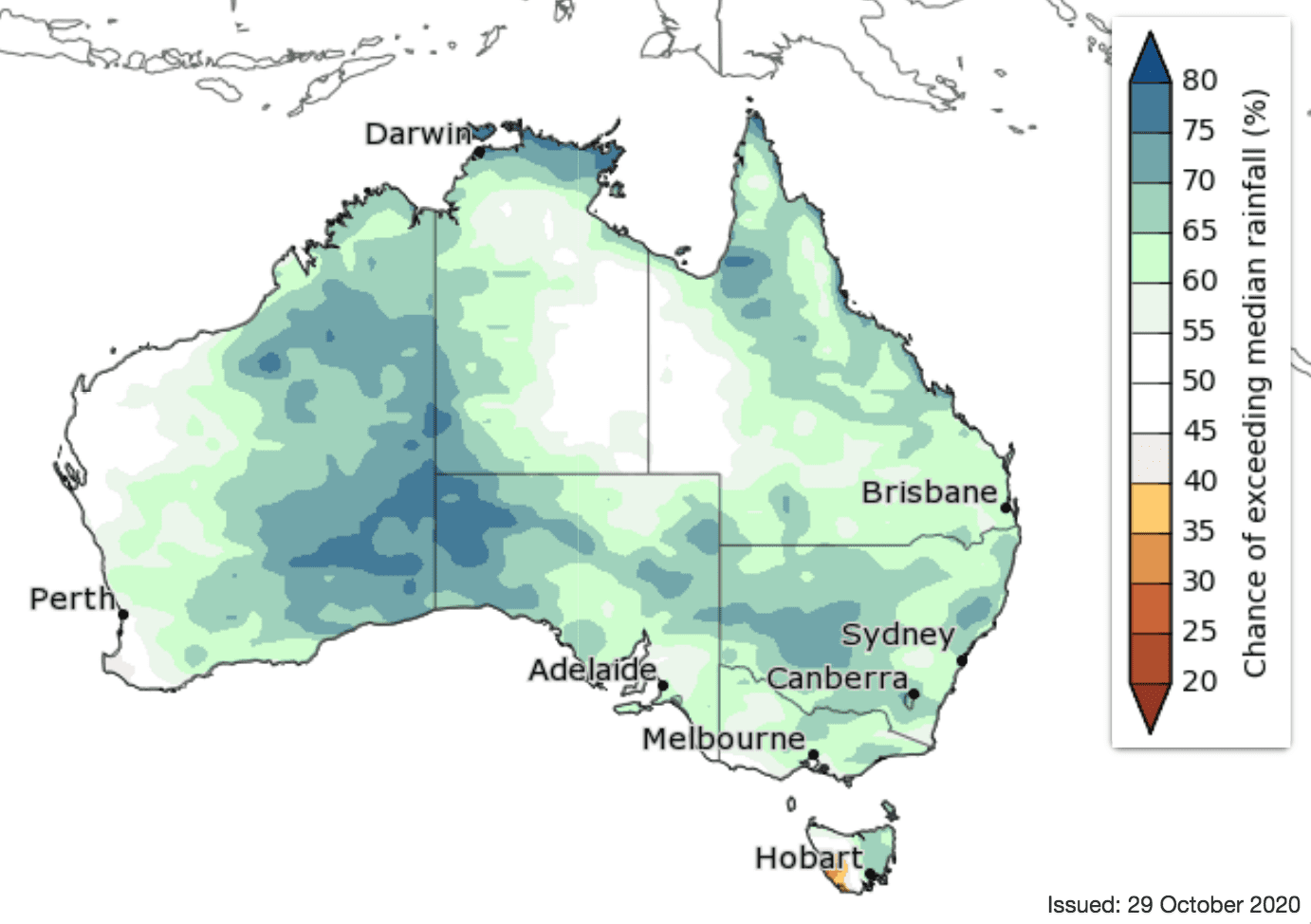
Rainfall outlook for NOVEMBER 2020
November to January is likely to be wetter than average for nearly all of Australia, with a greater than 65pc chance in most areas, but drier than average for parts of western Tasmania.
November rainfall is likely (greater than 65pc in many areas) to be above average across most of the eastern two-thirds of the Australian mainland. Remaining parts of Australia have roughly equal chances of a wetter or drier than average November apart from west coast Tasmania, where drier than average conditions are more likely.
The fortnight 2-15 November is likely to be wetter than average for northwest SA, southwest NT and the WA interior (greater than 75pc chance), as well as parts of the Queensland and NSW coasts (greater than 60pc chance). The far southwest of both WA and Victoria, as well as western Tasmania are more likely to experience drier than average conditions.
While the outlooks indicate wetter than average conditions, southern parts of Australia are entering into their drier season, so rainfall is not likely to be sufficient to relieve long-term rainfall deficits. This rainfall will also not necessarily lower the risk of days with elevated fire danger.
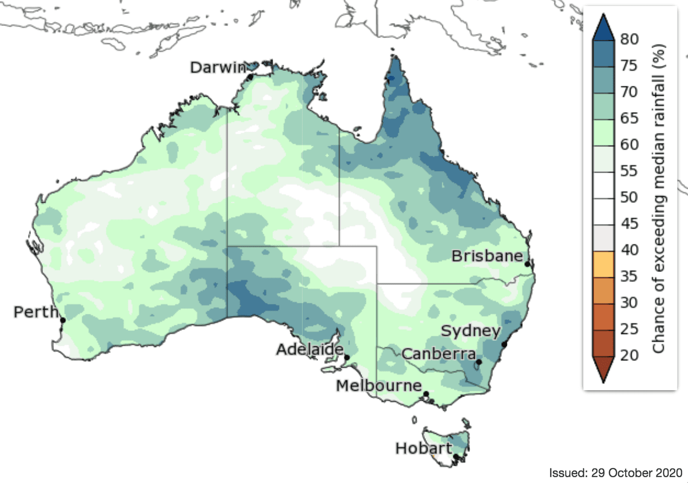
Rainfall outlook for DECEMBER 2020
‘First look’ December 2020 to February 2021 outlook:
Temperature outlook
Warmer days for much of the south-east, the far north and parts of the interior during November to January; warmer nights very likely for all of Australia.
For the fortnight 2-15 November, average daytime temperatures are likely to be above the long-term average for most parts of Australia apart from southwest WA, where roughly equal chances of warmer or cooler days are more likely. On average, nights during this period are likely to be warmer than the long-term average across all of Australia.
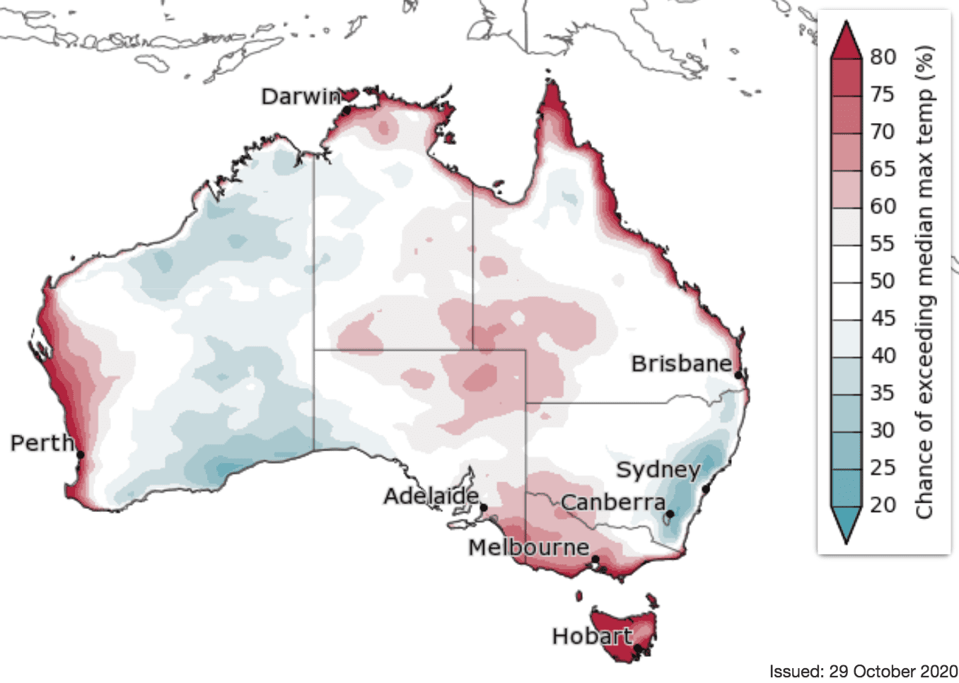
The average maximum temperature for November to January is likely to be higher than the long-term average for Tasmania, Victoria, northern and western WA, much of the NT and northern SA, and along the coast and towards the southwest of Queensland. However, it is likely to be cooler than the long-term average for south coast WA, eastern NSW, and far southeast Queensland.
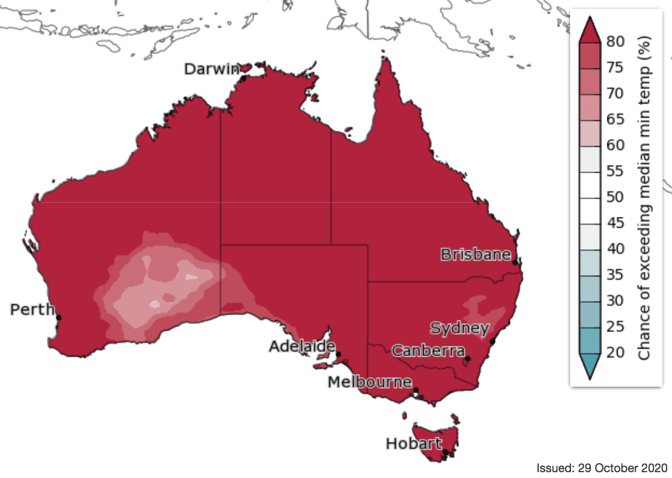
The average minimum temperature is very likely (greater than 80% chance) to be higher than the long-term average across Australia during November to January.
Source: Bureau of Meteorology. To view more outlook maps for coming weeks and months click here
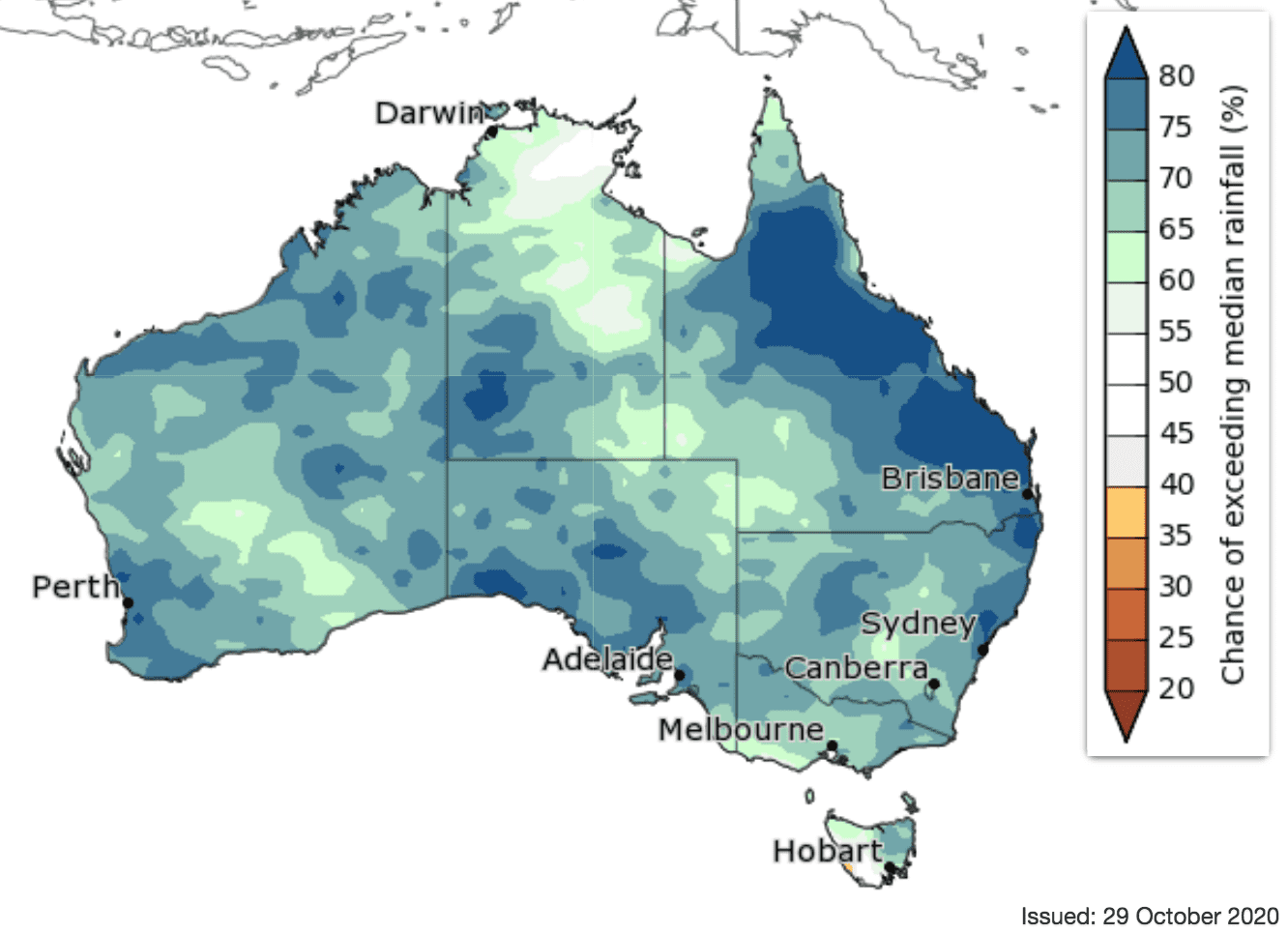
Previous forecast versus actual rainfall
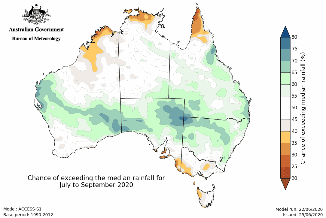
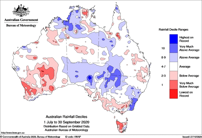
Maps below compare BOM’s rainfall forecast for July to September 2020, issued 25 June 2020, with actual rainfall recorded over the July to September 2020 period.
FORECAST MEDIAN RAINFALL JULY to SEPTEMBER 2020:
ACTUAL RAINFALL RECORDED JULY to SEPTEMBER 2020:
Source: Bureau of Meteorology