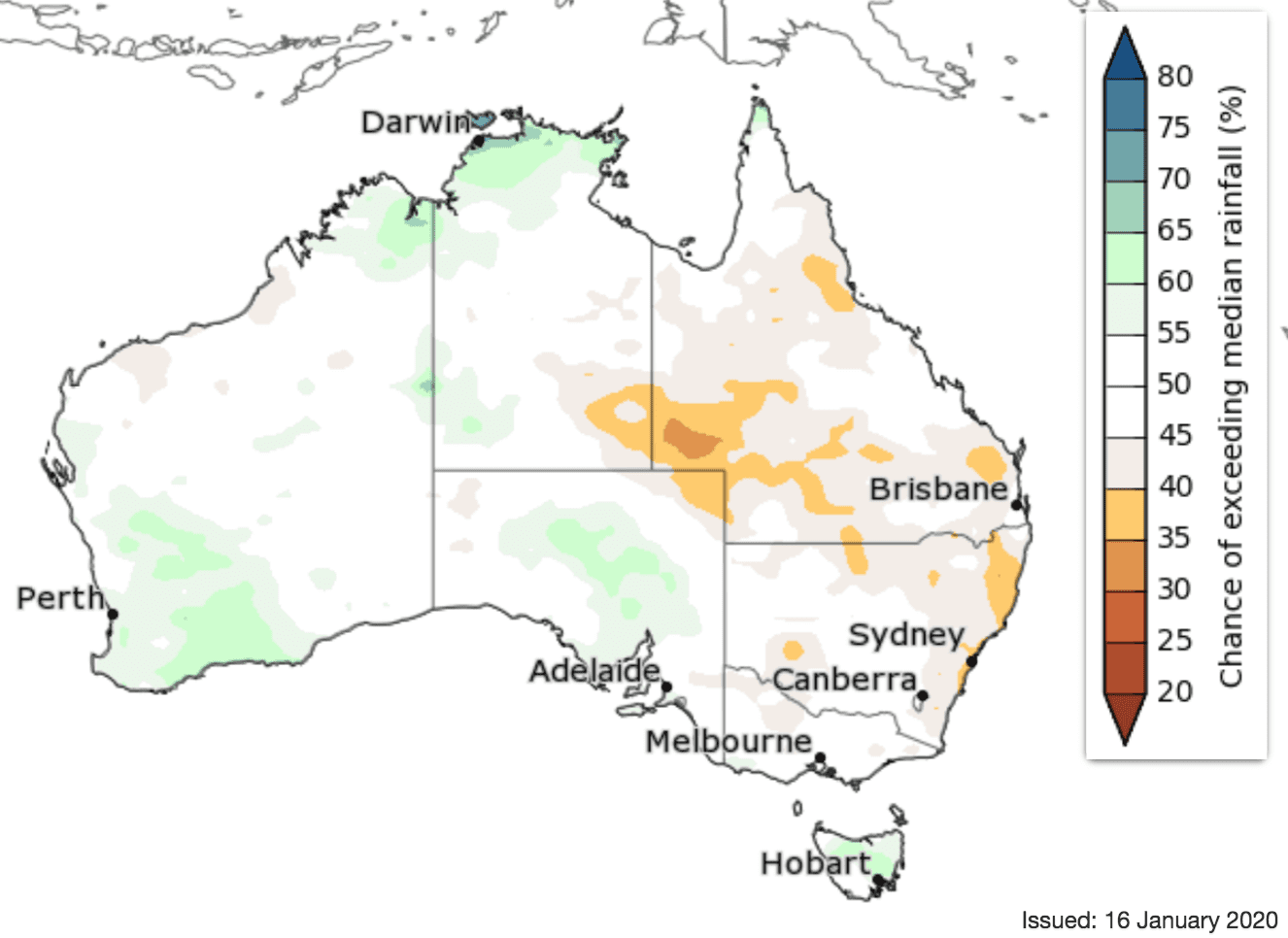
50:50 rainfall outlook for February to April
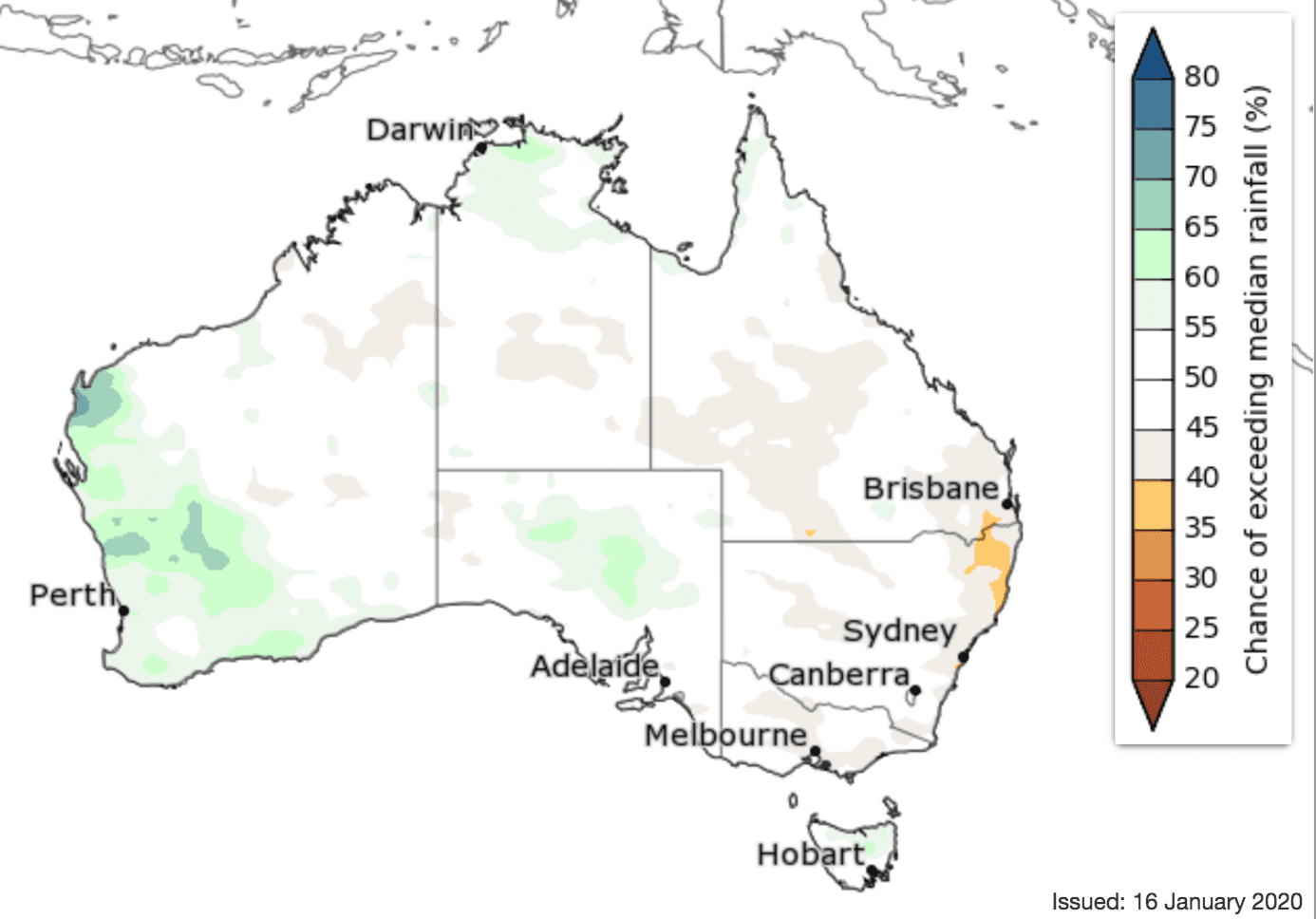
February to April has roughly equal chances of being wetter or drier than average for most of Australia, according to the Bureau of Meteorology latest seasonal climate outlook report.
This means there is no strong push towards wetter or drier than average conditions for the coming three months for most of the country.
Some small parts of the east are slightly more likely to be drier than average, while parts of the north are slightly more likely to be wetter than average.
While outlooks for drier than average conditions have eased compared to those issued for late 2019, several months of above average rainfall are needed to see a recovery from current long-term rainfall deficiencies.
Mar to May 2020 rainfall outlook:
Warmer days and nights likely for early 2020
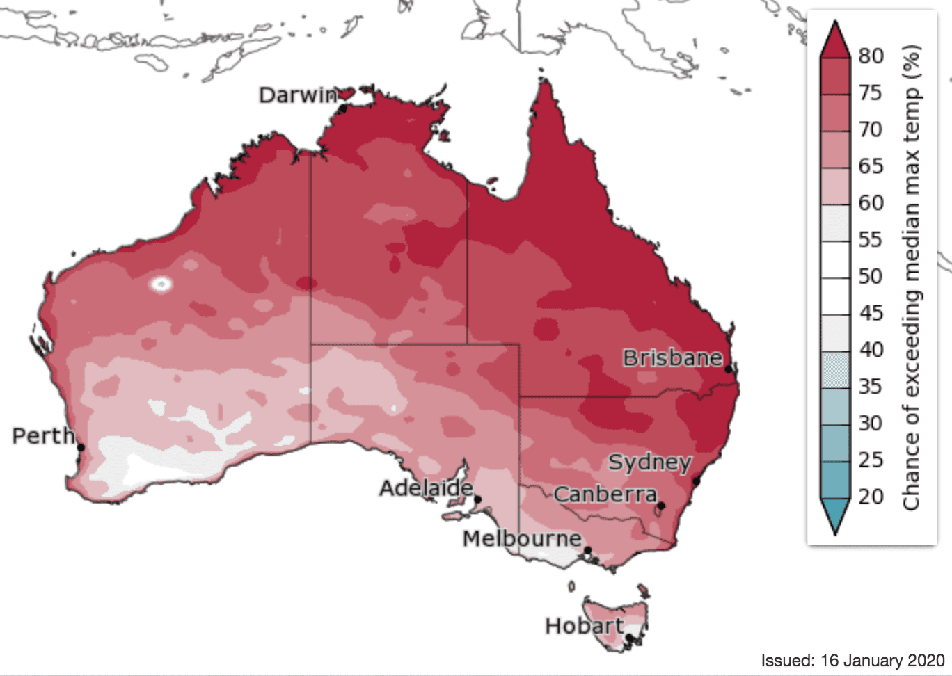
Chance of exceeding median maximum temperature
Daytime temperatures for February to April are likely to be warmer than average for almost all of Australia, with very high chances across the Top End of the NT, Queensland, and northern and eastern NSW. March to May is also likely to be warmer than average for most of the country, except parts of the south.
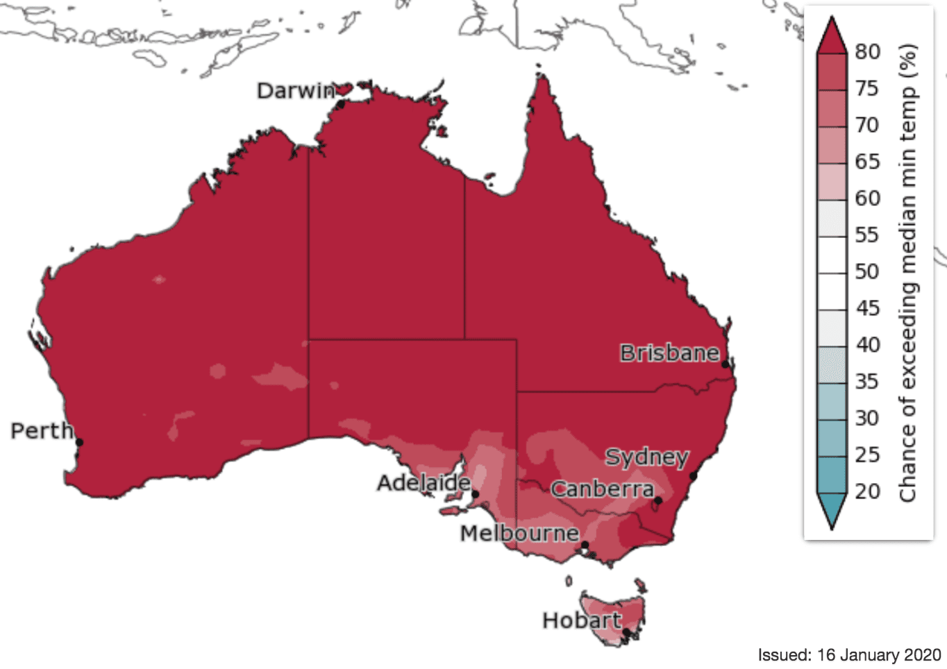
Warmer nights are likely almost nationwide for February to April, with very high chances (greater than 80% chance) likely for most areas except parts of the southeast. March to May nights are also likely to be warmer than average nationwide.
With warmer days and nights likely for the coming months, further heatwaves remain possible.
Chance of exceeding median minimum temperature
Source: Bureau of Meteorology. To view more outlook maps for coming weeks and months click here
Comparison – previous forecast versus actual rainfall
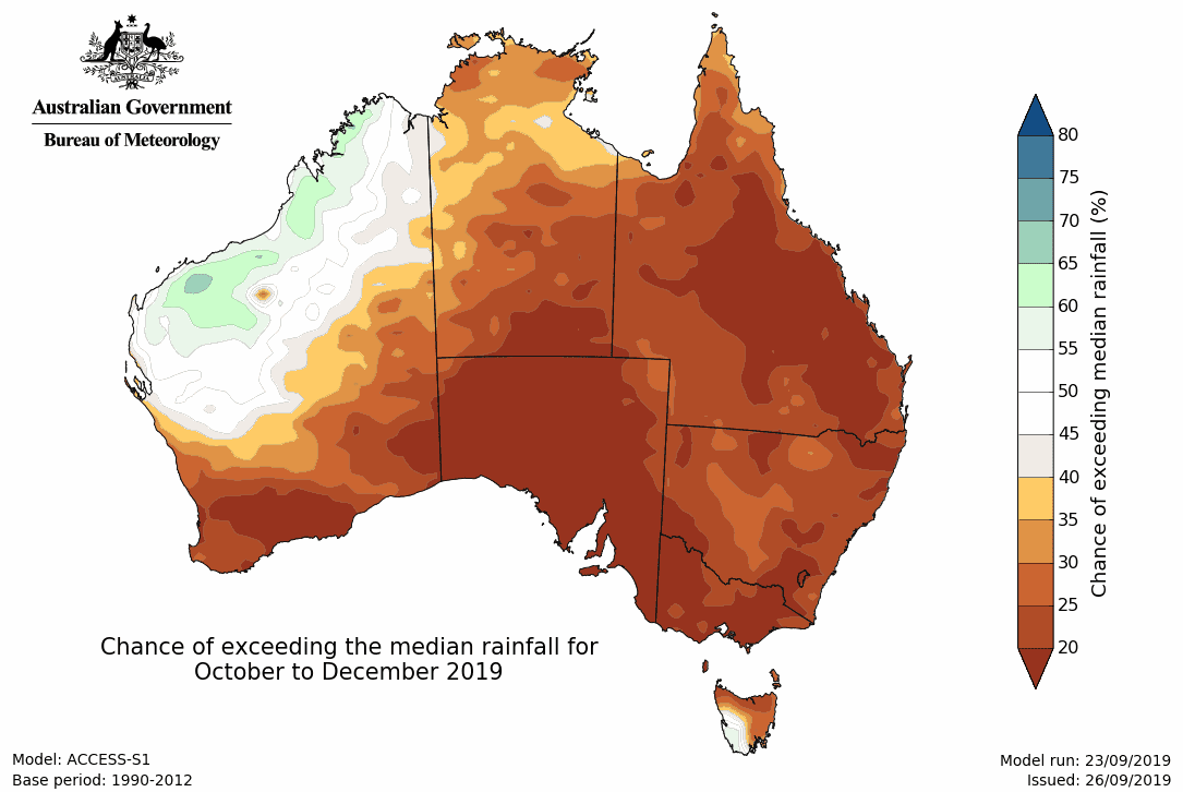
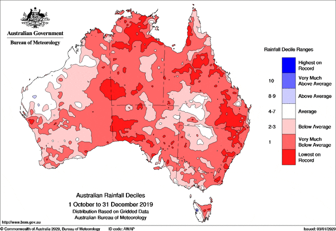
Maps below compare BOM’s rainfall forecast for October to December 2019, issued in September 2019, with actual rainfall deciles recorded over the October to December 2019 period.
FORECAST MEDIAN RAINFALL OCT to DEC 2019:
RAINFALL DECILES RECORDED OCT to DEC 2019:
Source: Bureau of Meteorology

