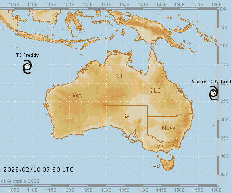
Severe Tropical Cyclone Gabrielle remains well offshore of the central Queensland coast as a Category 3 system.
 Despite being offshore and posing no threat to the mainland, the system is likely to produce wind gusts of 224 km/h causing hazardous coastal conditions for parts of Queensland and New South Wales. A Hazardous Surf Warning is current for both states, and unusual easterly swells may pose an increased risk for coastal activities and cause coastal erosion.
The cyclone continues to move in a south-east direction, roughly parallel to the Queensland coast and is forecast to track near or over Norfolk Island from Friday night or Saturday morning.
A Tropical Cyclone Warning has been issued for Norfolk Island, where heavy rain, damaging to destructive winds and heavy surf and swell are possible.
Severe weather across Norfolk Island may last for an extended period as TC Gabrielle moves over it, potentially until Sunday afternoon or evening.
The system will gradually weaken as it moves towards New Zealand’s North Island.
Tropical Cyclone Freddy
Tropical Cyclone Freddy, located around 690 km south/south-east of Christmas Island, is now a Category 2 system. The cyclone poses no threat to the Western Australian coast, Christmas Island or the Cocos (Keeling) Islands.
TC Freddy is likely to remain at tropical cyclone intensity as it moves west/south-west across the Indian Ocean.
To see the tropical cyclone forecast track map visit our website. For more information about tropical cyclones visit our knowledge centre.
Eastern Australia
Severe thunderstorms produced heavy to intense rainfall, flash flooding and strong to damaging winds over broad areas along the coast and Central West of New South Wales on Thursday.
The highest rainfall totals in the 24 hours to 9am Friday included:
– 149 mm at Erina Heights, NSW
– 134 mm at Bodalla, NSW
– 116 mm at Bellambi, NSW
– 95 mm at Audley, NSW
– 95 mm at Berkeley Vale, NSW
– 93 mm at Bega, NSW
– 92 mm at Wollongong, NSW
– 70 mm at Marsden, south-west of Dubbo, NSW
– 64 mm at Gosford, NSW
A 100 km/h wind gust was observed at Dubbo Airport, and 85 km/h on Sydney Harbour.
These totals follow falls of up to 380 mm in the previous 24 hours to 9am Thursday, which also caused significant damage and disruption around the Illawarra region.
Severe thunderstorms are possible today (Friday) over eastern New South Wales, eastern Victoria, and eastern Tasmania with the risk of heavy rain, damaging winds and large hail.
Warm to hot weather will return to much of south-eastern Australia in the coming days.
Maximum temperatures will be 5 – 10 C above average in eastern South Australia, western Victoria and western New South Wales on Friday, and then moving into the rest of Victoria, New South Wales and southern Queensland on Saturday.
Low to severe heatwave conditions are expected to develop in northern New South Wales and southern and central Queensland, where maximum temperatures will be 6 – 12 C above average and linger for multiple days. The focus of the heatwave conditions will be the Capricornia district.
Western Australia
Severe to locally extreme heatwave conditions will develop across much of inland Western Australia due to high temperatures which will be up to 10 C above average.
Heatwave Warnings are current for much of inland Western Australia and will continue through the weekend.
Maximum temperatures will reach the low to mid 40s for many days with large, but remote areas also exceeding 45 C.
High to Extreme Fire Danger is forecast in coming days across much of the state.
High temperatures and heatwave conditions are likely to continue well into next week and intensify over the south of the state.
Communities should stay up to date with the latest forecasts and warnings via our website and Bureau Weather app and follow the advice of emergency services.
Senior Meteorologist Jonathan How provides a video and audio news update available for download and use below: