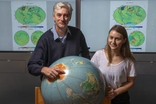
Dr Paul Tregoning and Rebecca McGirr from the ANU Research School of Earth Science
Dr Paul Tregoning’s team developed software to process the first publicly available data from the satellites and track water availability on Earth.
He said parts of New South Wales and Queensland, central South Australia, Tasmania and much of Western Australia were drier in December 2018 than the Millennium drought at the end of 2009.
“Our preliminary results show already the drought last year appeared to be worse across a large area of Australia than late 2009, towards the end of the Millennium drought,” said Dr Tregoning from the ANU Research School of Earth Sciences in a media released issued earlier this month.
“The Millennium drought, which lasted from 2001 until 2009, is considered by some experts to be Australia’s worst drought since European settlement.
“So to see the country in the grip of another bad drought less than a decade later points to more worrying times ahead.
“There was less water in the landscape in northern and northwestern NSW and southwestern Queensland in 2018 compared with 2009, but more water in the southern Murray-Darling Basin region and along the eastern coast.”
Data also documents Antarctic ice loss
The same satellite data also shows how much ice has been lost in Antarctica over the last decade.
Dr Tregoning said the ice loss in the Totten Glacier region, east of Australia’s Casey station in Antarctica, amounted to around 1.4 billion tonnes of water, which would fill around 570,000 Olympic-sized swimming pools.
“We could be watching the beginning of serious change to the ice sheet,” Dr Tregoning said.
“This is very concerning, since a destabilisation of the ice sheet in that region could affect the global sea level by many metres.”
The team used data from NASA’s Gravity Recovery and Climate Experiment (GRACE) satellites, which were decommissioned in October 2017, and the GRACE Follow On satellites, which were launched into orbit in May last year.
ANU PhD scholar Rebecca McGirr is researching ice loss in Antarctica using data from the GRACE space mission, which tracked the changes in water levels on Earth continuously from 2002 until 2017.
“With access to new ‘eyes in the sky’ through the GRACE Follow On mission, we can once again track the state of droughts and floods in Australia and ice loss in Antarctica. This means that society is much better informed about extreme climate conditions and long-term change,” said Ms McGirr.
Professor Matt King, an expert in polar motion from University of Tasmania, said the ANU team’s sophisticated analysis of GRACE Follow On data provided much-needed capability for Australian Antarctic research.
“The evidence of huge ice loss from the Totten Glacier region is of great concern,” he said.
“This is in Australia’s backyard, so we need to understand what is happening and what might happen in the future.”
This article was first published on the Australian National University website. To view original article click here