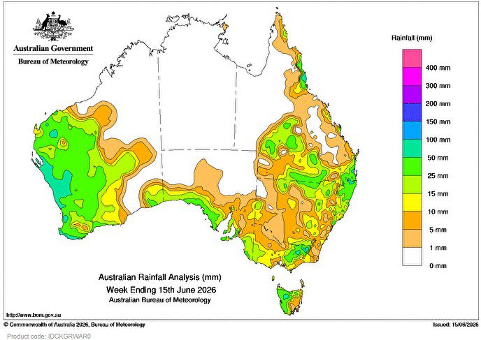
DURING the week, a slow-moving low pressure system with embedded cold fronts, interacted with an inland trough and moisture feeding from a north-west cloudband, to produce widespread rainfall and showers from the west, across the far south, and over much of eastern Australia.
 Weekly totals of 25–100 mm were recorded across the west of Western Australia, coastal South Australia, western Tasmania, the south-eastern ranges, and areas of southern Queensland to north-eastern New South Wales.
A persistent high pressure system in the Tasman Sea brought onshore flow with showers along the east coast, resulting in weekly rainfall totals of 10–50 mm, and locally higher falls to some coastal areas, particularly in northern Queensland.
The highest weekly total (at a Bureau gauge) of 171.0 mm was recorded at Topaz Alert (Queensland).
The highest daily total (at a Bureau gauge) of 81.8 mm was recorded at Eurardy (Western Australia) in the 24 hours to 9 am 12 June 2026.
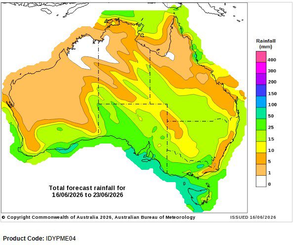
Seven-day rainfall outlook
HAVE YOUR SAY