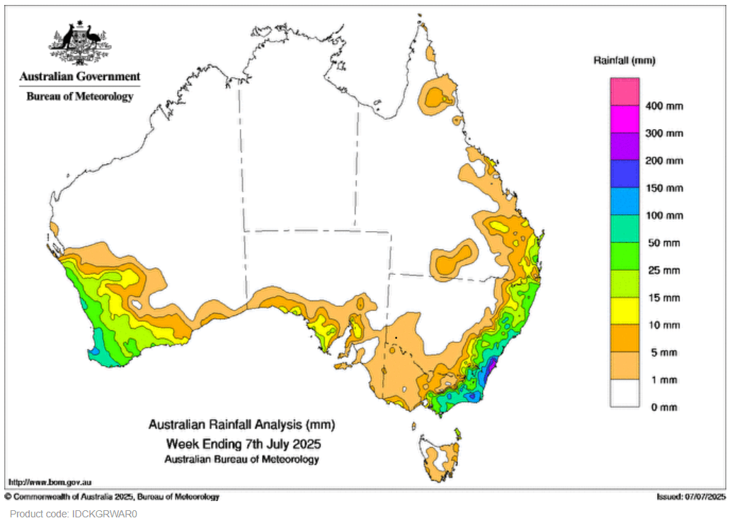
A DEEP low pressure system and associated troughs in coastal New South Wales triggered widespread rainfall over eastern parts of the state, as well as parts of south-eastern Queensland and eastern Victoria.
 An upper-level low triggered storms, some severe, over eastern New South Wales on 6 July.
Weekly rainfall totals of 25 to 300 mm were recorded across coastal regions of New South Wales, eastern Victoria and isolated patches in south-eastern Queensland.
Cold fronts and associated low pressure systems and troughs led to scattered rainfall and storms, some severe, across south-western parts of Western Australia, coastal regions of South Australia, New South Wales, Victoria and Tasmania.
Weekly rainfall totals of 15 to 100 mm, and locally higher falls, were recorded across the south-west of Western Australia and patches of southern coastal regions of South Australia.
The highest weekly total (at a Bureau gauge) was 341.4 mm at Jervis Bay (Jervis Bay Airfield AWS) in New South Wales.
The highest daily total (at a Bureau gauge) was 224.0 mm at Ulladulla AWS in New South Wales in the 24 hours to 9 am on 2 July.
HAVE YOUR SAY