
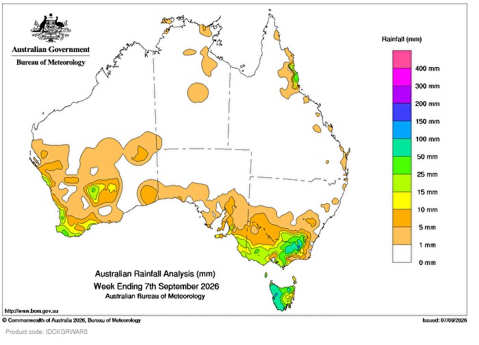
SEVERAL cold fronts moved across south-eastern Australia during the week, resulting in days of rainfall and flood warnings for catchments in northern Victoria and northern Tasmania.
 Weekly rainfall totals greater than 15 mm were recorded across Tasmania, south-eastern South Australia, south-eastern New South Wales and southern, central and north-eastern Victoria. Falls greater than 50 mm were recorded in western Tasmania and alpine regions of Victoria and New South Wales.
Several cold fronts crossed south-west Western Australia during the week, followed by a trough and low pressure system supported by a slow moving upper trough, which brought rainfall to inland parts of the state.
Weekly rainfall totals greater than 10 mm were recorded along parts of the west coast of Western Australia and in areas of the south-west and the interior. Isolated falls of 25 to 50 mm were recorded in the South West and Goldfields districts.
A high pressure system in the Tasman Sea directed moist onshore flow to coastal areas of Queensland.
Weekly rainfall totals between 15 to 50 mm were recorded across Queensland’s North Tropical Coast and Tablelands and the Herbert and Lower Burdekin districts.
The highest weekly total (at a Bureau gauge) was 159.6 mm at Mount Read in Tasmania.
The highest daily total (at a Bureau gauge) was 80.8 mm at Perisher Valley AWS in New South Wales in the 24 hours to 9 am on 6 September 2026.
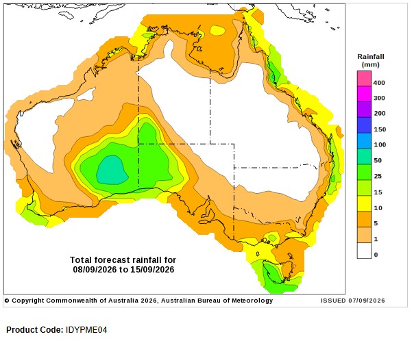
Seven-day rainfall outlook
HAVE YOUR SAY