
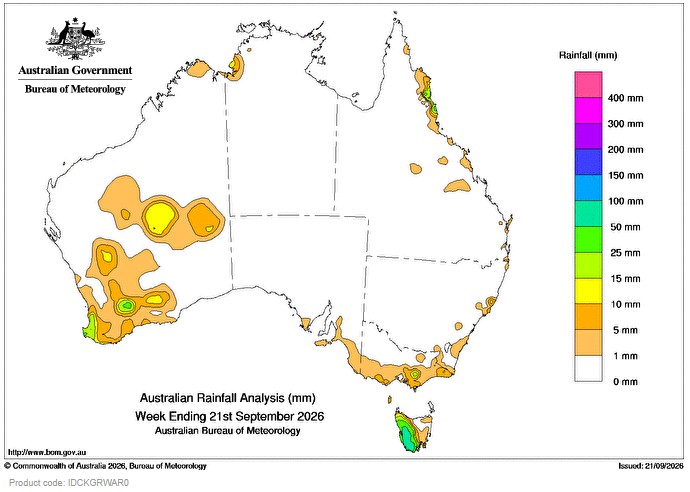
A COLD front and associated trough brought scattered rain and showers to parts of the south-east on the 15th. Later in the week, another cold front brought showers to the south-west on the 18th and to the south-east on 19th and 20th.
Weekly rainfall totals of 10 to 100 mm were recorded across much of western Tasmania and parts Victoria and the south-west of Western Australia.
Moist onshore winds earlier in the week brought scattered showers to parts of the north-eastern coast of Queensland.
Weekly rainfall totals of 10 to 50 mm were recorded across coastal parts of northern tropical coast Queensland.
Isolated storms and showers from a surface trough impacted inland regions of Western Australia on the 14th and 15th.
Weekly rainfall totals of 10 to 25 mm were recorded across parts of the Goldfields and Interior regions of Western Australia.
The highest weekly total (at a Bureau gauge) was 87.6 mm at Mount Read in Tasmania.
The highest daily total (at a Bureau gauge) was 29.6 mm at Paynedale Alert in Western Australia in the 24 hours to 9 am on 19 September.
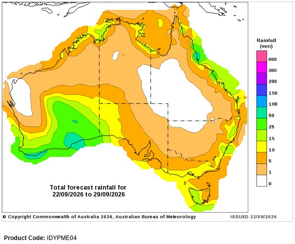
Seven-day rainfall outlook
HAVE YOUR SAY