
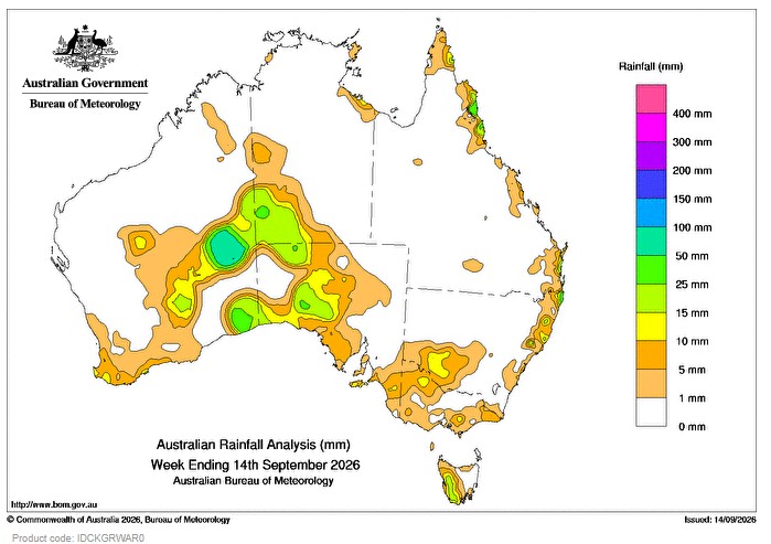
BETWEEN 8 and 10 September, a low pressure system supported by a slow-moving upper trough, and the associated surface troughs, brought rainfall to inland and southern parts of Western Australia, south-western Northern Territory and much of South Australia.
Weekly rainfall totals greater than 15 mm were recorded across parts of inland and south-eastern Western Australia extending into south-western Northern Territory, and areas in western South Australia. Falls greater than 50 mm were recorded in parts of Western Australia’s Southern Interior district.
On 12 and 13 September, a cold front and the associated trough moved across parts of southern Australia generating light to moderate rainfall.
Weekly rainfall totals between 10 and 25 mm were recorded in small areas in the far south-west of Western Australia, north-western Victora and adjacent parts of New South Wales, and much of western Tasmania.
Throughout the week, a high pressure system directed moist onshore flow to the east coast of Australia.
Weekly rainfall totals between 10 and 50 mm were recorded in small areas of coastal Queensland and northern New South Wales.
The highest weekly total (at a Bureau gauge) was 58.4 mm at Warburton Airfield in Western Australia, including the highest daily total of 40.2 mm in the 24 hours to 9 am on 9 September 2026.
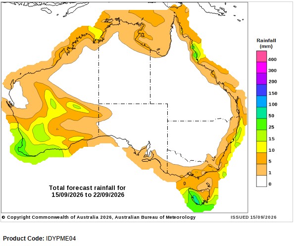
Seven-day rainfall outlook
HAVE YOUR SAY