
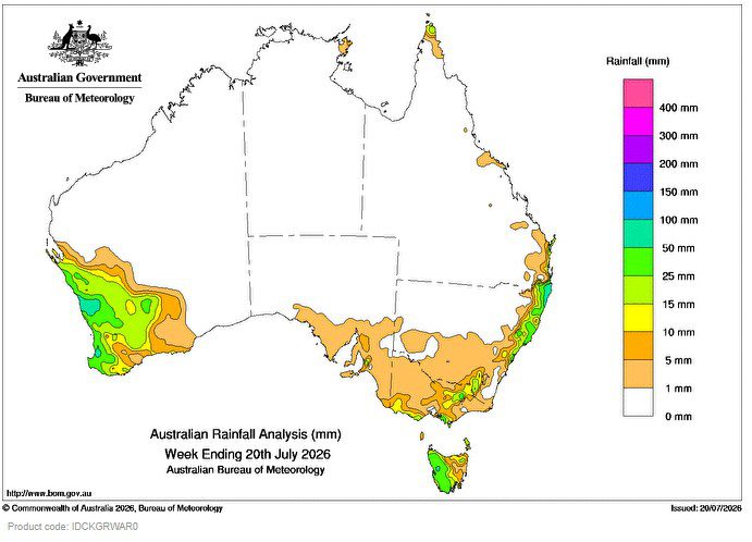
A cold front moved over the south-east on 13 July, followed by a trough on 14 July.
Weekly totals up to 10 mm were recorded about the south-east with locally higher totals of 10 to 50 mm about western Tasmania and southern and alpine regions of Victoria.
 A trough developed along the east coast, enhancing showers as it developed into a low pressure system later in week with isolated thunderstorms.
Weekly totals of 25 to 50 mm were recorded about the east coast with locally higher totals of 50 to 150 mm about the Mid North Coast and Northern Rivers in New South Wales.
A cold front moved over Western Australia on 16 July, resulting in rain and showers about the south-west, and was followed by another cold front on 17 and 18 July.
Weekly totals of 15 to 25 mm were recorded about the South West Land Division in Western Australia with locally higher totals up to 80 mm near the coast.
The highest weekly total (at a Bureau gauge) of 150.0 mm was recorded at Meldrum (Coolawarrah) in New South Wales.
The highest daily total (at a Bureau gauge) of 81.0 mm was recorded at Green Grove in Western Australia in the 24 hours to 9 am on 18 July.
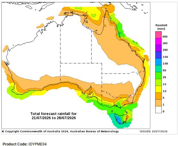
Seven-day rainfall outlook
HAVE YOUR SAY