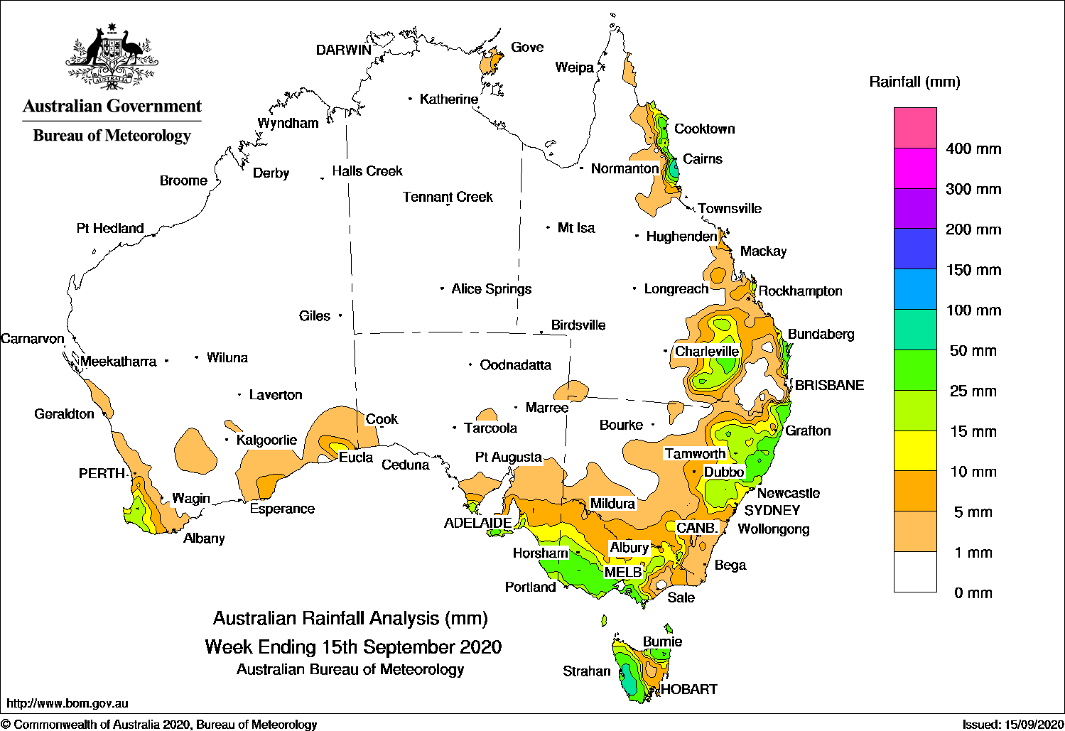
Past seven days: At the start of the week, a high pressure system in the Tasman Sea extended a firm ridge along the east coast, and moist onshore flow produced showers along parts of Queensland’s north tropical, central and south-east coasts
In the first part of the week, a cold front moved away from the south-east, and a broad trough stretched from Central Australia to New South Wales to the west of Tasmania, and tracked eastwards over south-east Australia. The systems tracked eastward and generated widespread light falls over Tasmania, the eastern half of Victoria and south-east New South Wales. Moderate falls were reported in south-west Tasmania.
The surface tough tracked over northern New South Wales and southern Queensland and produced widespread moderate falls in the north-east, and adjacent inland districts in New South Wales. Thunderstorms developed over south-east inland Queensland.
In the west, a cold front brushed the south-west of Western Australia then slipped into the Bight, generating moderate falls in far south-west, and light falls in the far south-east of the state.
During the middle of the week, the cold front stretched across the far south-east of the country, and the associated slow-moving cloudband tracked across south-east Australia. Moderate falls were recorded in south-east South Australia, and in south-west, central and north-eastern Victoria, and Tasmania. At the end of the week, another fast-moving cold front embedded in a westerly flow, tracked across Tasmania and generated moderate falls in that state’s west and north-east.
Onshore flow continued along parts of the east coast of Queensland for the rest of the week, with heavier showers affecting the north tropical Queensland coast.
Rainfall totals in excess of 100 mm were recorded in parts of the north tropical and south-east coasts of Queensland; also in an area in north-east New South Wales, including the highest weekly totals of 119 mm at Meldrum (Coolawarrah).
Rainfall totals between 10 mm and 50 mm were recorded in far south-west Western Australia; south-east South Australia; most of Victoria except in the north-west and east, and in western and north-eastern Tasmania. Similar totals were recorded in elevated areas of the Snowy Mountains, and from the central to north coasts, and adjacent inland districts of New South Wales; and across south-east inland Queensland and along the north tropical, central and south-east coasts of that state.
Highest weekly totals
New South Wales and Australian Capital Territory
119 mm Meldrum (Coolawarrah)
81 mm Careys Peak (Barrington Tops)
75 mm Mooral Creek (The Den)
Victoria
55 mm Main Ridge
52 mm Balmoral (Post Office), Derrinallum (Post Office)
Queensland
116 mm Rainbow BeachSandy Cape Lighthouse
105 mm Tin Can Bay (Defence)
Western Australia
47 mm Nannup
37 mm Kirup
30 mm Donnybrook
South Australia
36 mm Nangwarry Forestry Sa Depot
35 mm Coonawarra
32 mm Lake George (Maharishi Vedic CNaracoorte Aerodrome
Tasmania
87 mm Strathgordon Village
74 mm Lake Margaret Dam
66 mm Lake Margaret Power Station
Northern Territory
5 mm Gove Airport
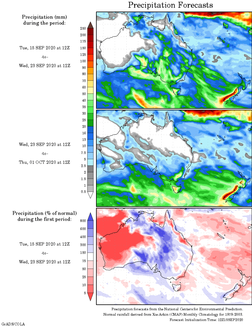
Rainfall outlook


HAVE YOUR SAY