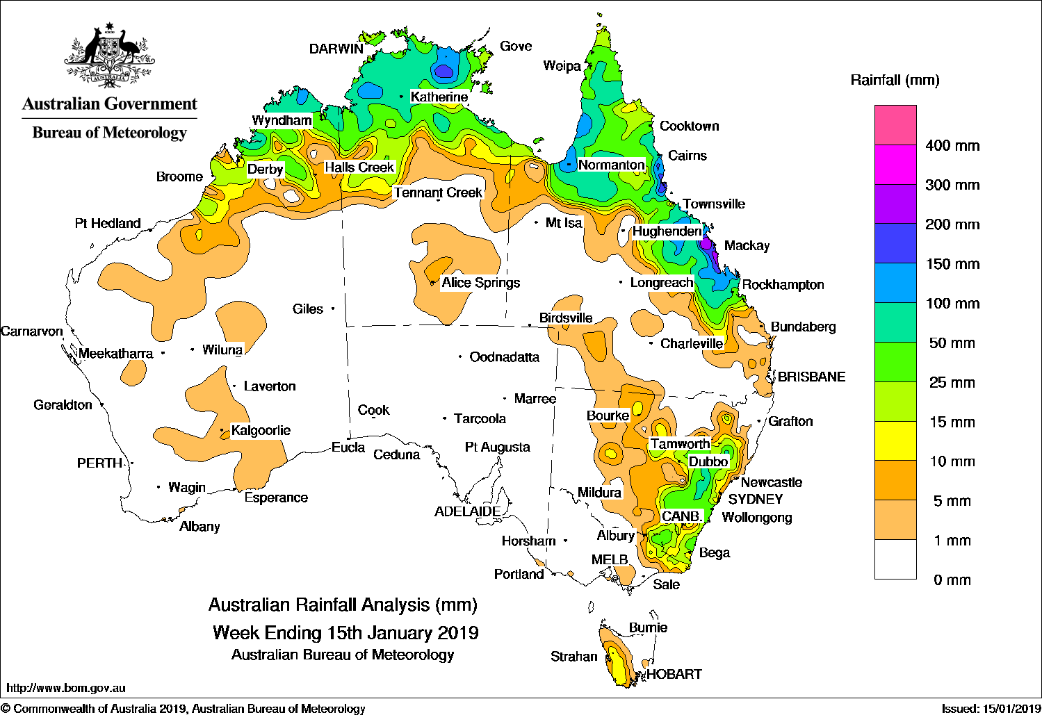
A trough linked with remnants of ex-tropical cyclone Penny and produced moderate falls in northern Queensland, while a trough brought moderate falls to eastern New South Wales.
The highest weekly total was 317 mm at Cardwell Range in north Queensland.
Past seven days: At the start of the week, a low to middle level cloudband over eastern Queensland and northeastern New South Wales was due to the remnants of ex-tropical cyclone Penny located over Bowen, with moderate to locally heavier falls recorded around the Capricornia Coast. Thunderstorms developed over the Top End of the Northern Territory and Cape York Peninsula near a broad surface trough that stretched across northern Australia, through western Queensland and New South Wales to the southeast of Australia. Showers and thunderstorms with moderate falls were recorded in southeastern New South Wales and parts of eastern Victoria. A cold front tracked across Tasmania and brought light falls to the west of the State.
By the middle of the week, a trough over central Queensland shifted northwards, with showers and thunderstorms producing further moderate falls along the central to north tropical coast, Cape York Peninsula, Gulf Country and the northern interior of the State. Widespread showers and thunderstorms developed along a trough extending through inland New South Wales and eastern Victoria, and produced moderate falls in central to southeastern parts of the State. Thunderstorms and showers continued to develop near a broad surface trough across northern Australia.
In the last part of the week, active areas of thunderstorms and showers persisted across northern Australia, with moderate falls recorded in the Kimberley in Western Australia, much of the Top End in the Northern Territory, the Gulf Country and Cape York Peninsula in Queensland.
Rainfall totals in excess of 200 mm were recorded in the north tropical and central coasts of Queensland, including the highest weekly total of 317 mm at Cardwell Range in north Queensland.
Rainfall totals exceeding 100 mm were recorded along parts of Queensland’s east coast, about the Gulf Country, in small areas of the Top End in the Northern Territory, and an area in the northern Kimberley in Western Australia.
Rainfall totals between 50 mm and 100 mm were recorded in the northern Kimberley in Western Australia, most of the Top End in the Northern Territory, the western Cape York Peninsula, much of the east coast of Queensland between Cairns and Gladstone, and an area in central New South Wales.
Rainfall totals between 10 mm and 50 mm were recorded in remaining parts of the Kimberley in Western Australia, much of the northern half of the Northern Territory, the Gulf Country, the Cape York Peninsula, eastern Queensland, eastern New South Wales, parts of eastern Victoria, and western Tasmania.
Little of no rainfall was recorded in remaining parts of Western Australia, the southern half of the Northern Territory, South Australia, western and southern Queensland, western New South Wales, most of Victoria away from the east and eastern Tasmania.
Highest weekly totals
New South Wales and Australian Capital Territory
94 mm Glen Alice
93 mm Bathurst Airport AWS
86 mm Oberon (Albion St)
Victoria
38 mm Hunters Hill
31 mm Corryong Airport
30 mm Mount Delegate
Queensland
317 mm Cardwell Range
287 mm Mirani Mary Street
271 mm Plane Creek Sugar Mill
Western Australia
126 mm Kalumburu
91 mm Theda
66 mm Kununurra Checkpoint
South Australia
1.6 mm Mount Gambier Aero
1.4 mm Parawa
1.2 mm Robe
Tasmania
22 mm Mount Read
17 mm Tim Shea (Summit)
15 mm Lake Margaret Power Station
Northern Territory
143 mm Fish River
136 mm Bulman
132 mm Milingimbi Airport
More weekly rainfall totals:
- NSW/ACT totals click here
- Vic totals click here
- Qld totals click here
- WA totals click here
- SA totals click here
- Tas totals click here
- NT totals click here
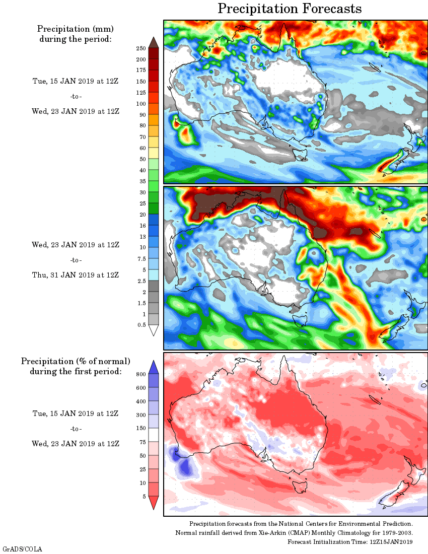
Rainfall outlook:


HAVE YOUR SAY