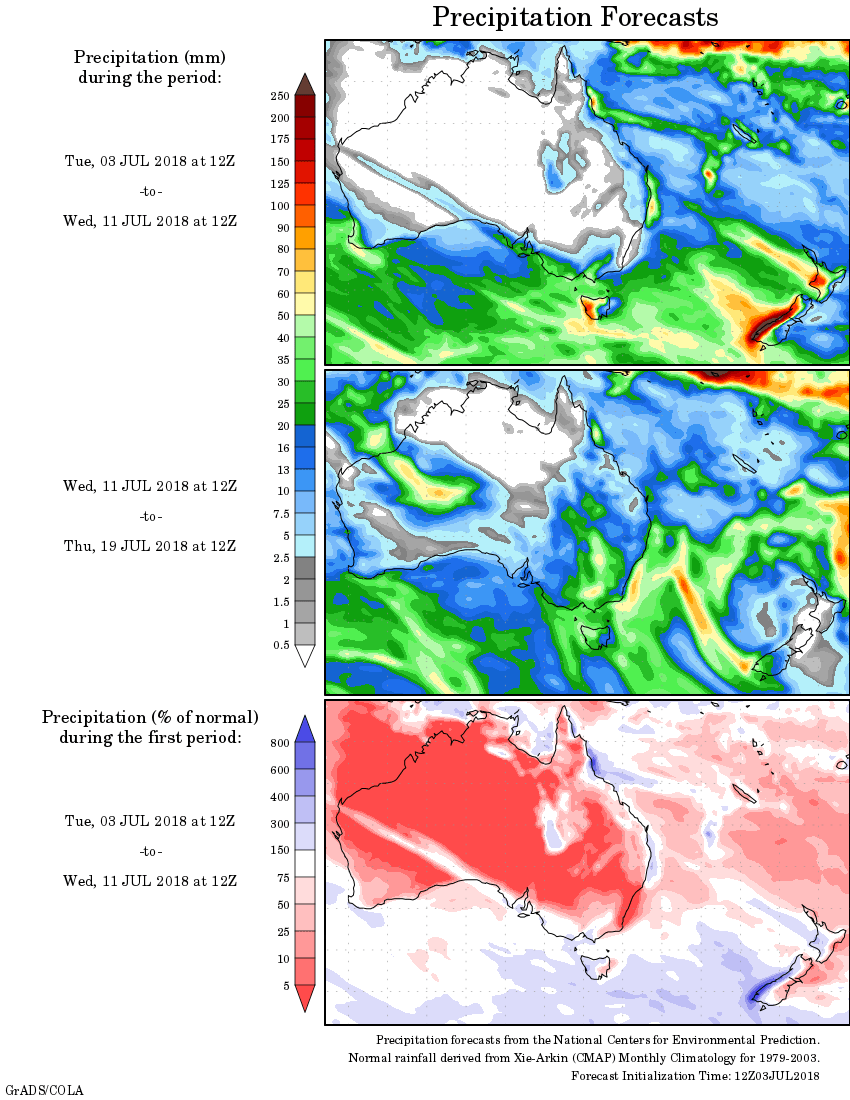
For today’s 14-day rainfall outlook – scroll to bottom of article
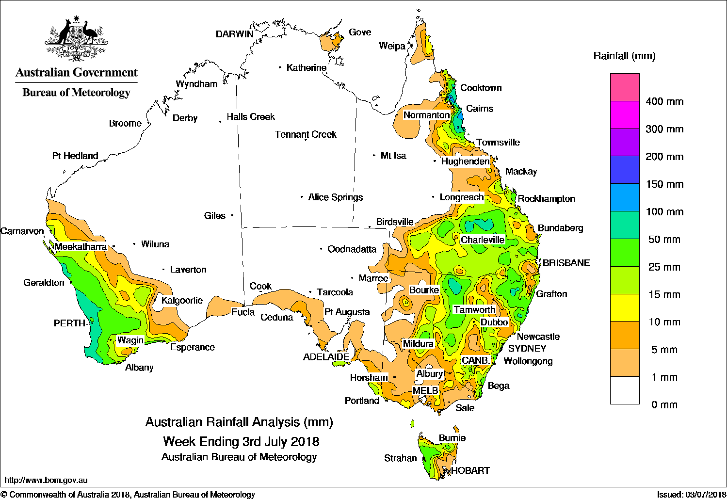
A surface and upper level trough produced moderate falls in southern Queensland and central New South Wales, while a cold front tracked across west and southern Australia, with moderate to heavy falls recorded near the west coast of Western Australia.
Past seven days: At the start of the week, a surface trough extending through inland Queensland and New South Wales combined with an upper level disturbance, generating showers and moderate falls across southern Queensland. Moderate falls were also recorded in northern and central New South Wales. Light to moderate falls were later reported in eastern New South Wales as a trough formed near the coast. In the west, a weak cold front tracked over southwest Western Australia, with light to moderate falls recorded across the South West Land Division.
The cold front continued to track eastwards across southern Australia in the middle of the week. The associated rainband brought light to moderate falls to southeastern South Australia, southwest and southern central Victoria, and western Tasmania.
At the end of the week, a cloudband associated with a cold front moved through western parts of Western Australia, which connected to a low pressure system near the State’s southwest coast. Widespread moderate rainfall with locally heavy falls was recorded in the western Gascoyne and South West Land Division. In the east, the persistent inland surface trough extending through western Queensland interacted with an upper level disturbance, generating thunderstorms and showers. Widespread moderate falls were recorded through the southern and southeastern interior districts in Queensland, and across the border into northeastern New South Wales.
Onshore southeasterly airflow generated persistent showers and moderate falls in the north tropical Queensland coast throughout the week.
Rainfall totals in excess of 50 mm were recorded in along the west coast of Western Australia, an area in the northern interior of New South Wales, parts of the southern interior of Queensland, and the north tropical Queensland coast. The highest weekly total was 163 mm at Innisfail in northern Queensland.
Rainfall totals between 10 mm and 50 mm were recorded in the South West Land Division and adjacent inland areas in Western Australia, parts of the exposed southeast of South Australia and southwest Victoria, areas of southern central and northeastern Victoria, western Tasmania, most of central to eastern New South Wales, southern Queensland, and the north tropical Queensland coast.
Little or no rainfall was recorded in remaining parts of Western Australia, the Northern Territory, most of South Australia away from the southern coast, northwestern and eastern Victoria, eastern Tasmania, western New South Wales, and western and northern Queensland away from the east coast.
Highest weekly totals
New South Wales and Australian Capital Territory
115 mm Jervis Bay
111 mm Yarras (Mount Seaview)
107 mm South West Rocks
Victoria
16 mm Gabo Island Lighthouse, Yarragon South, Main Ridge
Queensland
163 mm Innisfail
149 mm Tully Sugar Mill
117 mm South Johnstone Exp Stn
Western Australia
122 mm Boyanup North
115 mm Ferguson Valley, Bunbury
South Australia
23 mm Kingscote Aero, Lake George
21 mm Parndana (Turkey Lane), Kalangadoo (Mirnat)
Tasmania
64 mm Mount Read
58 mm Mount Barrow (South Barrow)
46 mm Zeehan
Northern Territory
23 mm Gove Airport
2 mm Alcan Minesite
1.8 mm Ngayawili
More weekly rainfall totals:
- NSW/ACT totals click here
- Vic totals click here
- Qld totals click here
- WA totals click here
- SA totals click here
- Tas totals click here
- NT totals click here
Source: BOM
Rainfall outlook:


HAVE YOUR SAY