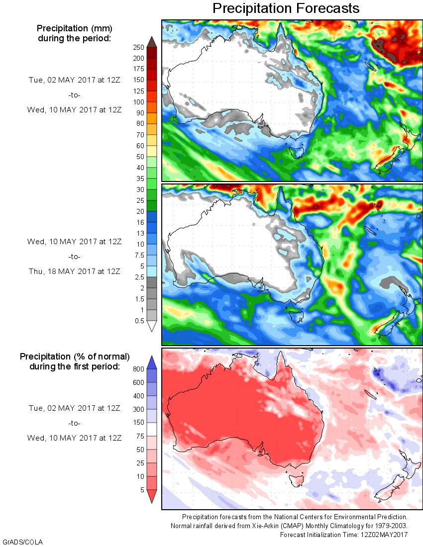
For today’s 14-day rainfall outlook – scroll to bottom of article
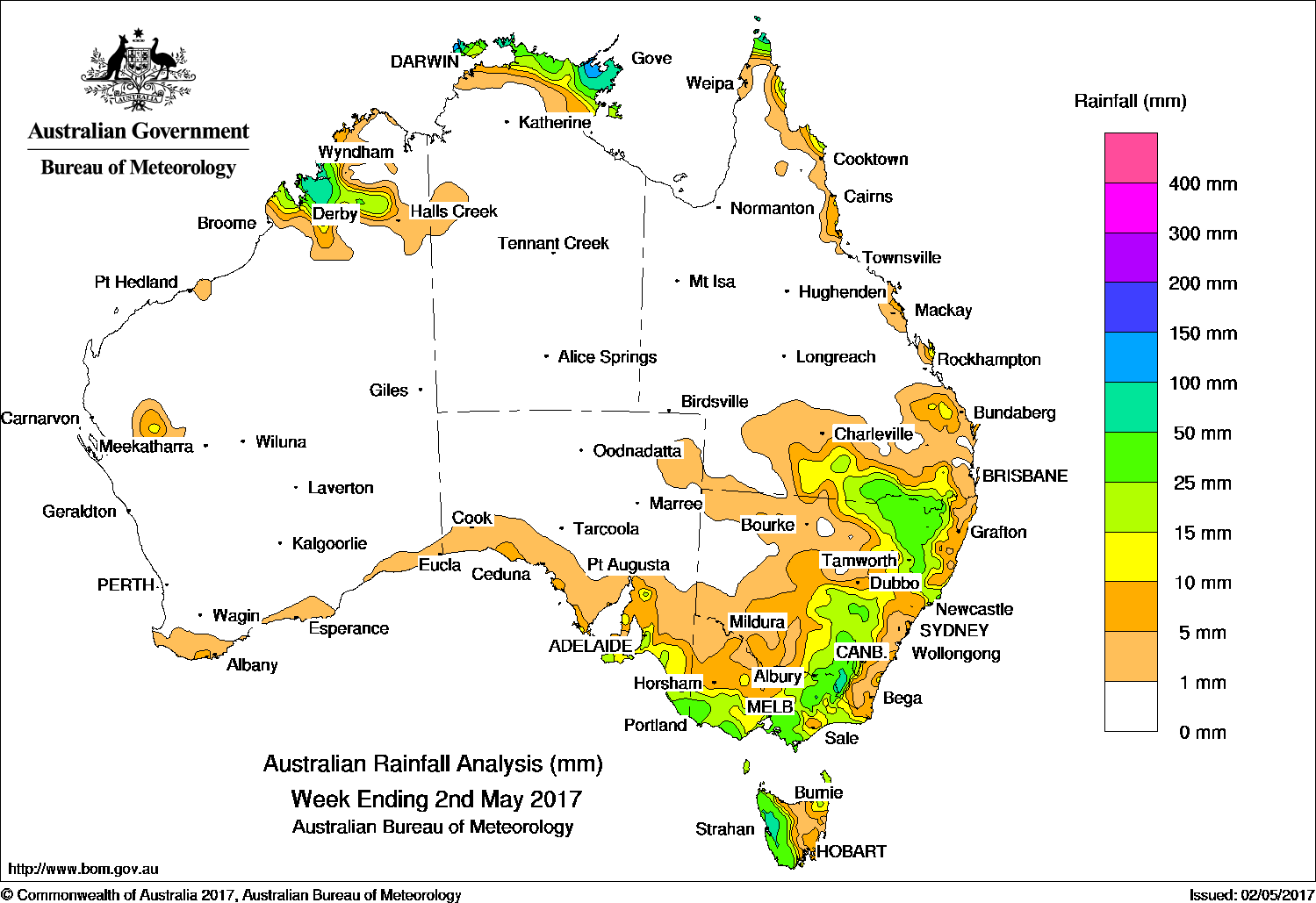
Rainfall was recorded in the Kimberley district in Western Australia, the northern Top End of the Northern Territory, Cape York Peninsula, east coast and southern Queensland, eastern New South Wales, Victoria, southeastern South Australia and Tasmania.
Past seven days: At the start of the week, a surface trough and cold front tracked eastwards across southeastern Australia, generating widespread light to moderate rainfall totals in southern and southeastern Queensland, eastern New South Wales, Victoria, southeastern South Australia, and Tasmania.
A tropical low located to the north of the Top End enhanced shower and thunderstorm activity, with moderate rainfall totals recorded across the tip of the Cape York Peninsula and Arnhem Land in the Northern Territory.
From the middle of the week, the tropical low intensified, and was named tropical cyclone Francis on 27 April 2017. Moderate falls associated with the tropical cyclone were recorded in the northern Top End of the Northern Territory. Frances intensified to a severe tropical cyclone as it tracked southwest along the Kimberley coast of Western Australia, bringing moderate falls to the western Kimberley district in Western Australia.
A series of weak cold fronts tracked across southern Australia during the week, producing mainly light falls across southeastern South Australia and southern Victoria. A vigorous cold front tracked across southeastern Australia at the end of the week, producing moderate rainfall totals in western Tasmania, and widespread light rainfall to southern Victoria and South Australia.
Rainfall totals exceeding 100 mm were recorded in pockets of Arnhem Land and the Darwin–Daly districts in the Northern Territory, including the highest weekly rainfall total of 234 mm at Pirlangimpi Airport in the Northern Territory.
Rainfall totals between 50 mm and 100 mm were recorded in larger pockets in Arnhem Land and the Darwin–Daly districts in the Northern Territory, the western Kimberley in Western Australia, elevated parts of the Snowy Mountains in New South Wales and an area in western Tasmania.
Rainfall totals between 10 mm and 50 mm were recorded in remaining areas of the Top End in the Northern Territory, western Kimberley, the Cape York Peninsula, and in southern and southeastern Queensland. Similar totals were recorded in northeastern and the central and southern Tablelands in New South Wales, in the eastern, northeastern and southern Victoria, southeastern South Australia, and in western and northeastern Tasmania.
Little or no rainfall was recorded in Western Australia except for the western Kimberley; the Northern Territory away from the northern Top End; most of Queensland away from the far north, the south and southeast; western New South Wales; northwestern Victoria; South Australia away from the southeast, and in most of the eastern half of Tasmania except the northeast.
Highest weekly totals list
New South Wales and Australian Capital Territory
68 mm Thredbo AWS
67 mm Perisher Valley AWS
66 mm Thredbo Village
Victoria
64 mm Mount Hotham
58 mm Ferny Creek
57 mm Mount Baw Baw
Queensland
50 mm Horn Island
48 mm Talwood State School
46 mm Nindigully
Western Australia
59 mm Kimberley Downs
39 mm Napier Downs
31 mm Old Mornington Homestead
South Australia
46 mm Nangwarry Forestry SA Depot
37 mm Adelaide
34 mm Mount Gambier Aero
Tasmania
126 mm Mount Read
59 mm Strahan (Andrew Street)
56 mm Savage River Mine
Northern Territory
234 mm Pirlangimpi Airport
142 mm Ngayawili
82 mm Nhulunbuy
More weekly rainfall totals:
- NSW/ACT totals click here
- Vic totals click here
- Qld totals click here
- WA totals click here
- SA totals click here
- Tas totals click here
- NT totals click here
Source: BOM


HAVE YOUR SAY