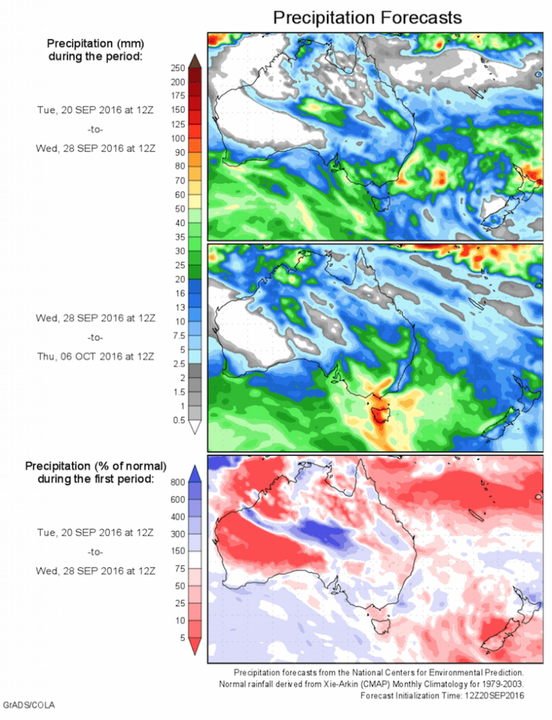
Today’s 14-day rainfall outlook – scroll to bottom of article
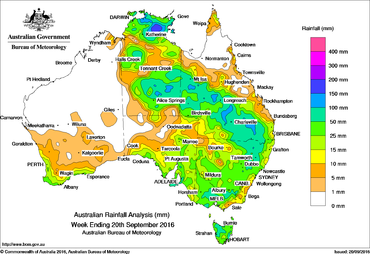
The best falls for the past week were recorded across a broad area extending from the Top End across the southern half of the Northern Territory, through western and central Queensland to inland northeast New South Wales.
Past seven days: Early in the week, a middle-level trough and an associated cloudband moved across central Australia, producing moderate to heavy rainfall across southern Queensland, and northeast New South Wales. Meanwhile, a low pressure system over western Victoria tracked southeast through Bass Strait and Tasmania, producing widespread rainfall across much of eastern Australia including heavy rainfall on the Mount Lofty ranges in South Australia. In the west a weak cold front tracked across southwest Western Australia bringing light to moderate rainfall along coastal areas.
During the second half of the week an upper-level trough and associated surface trough extended across the Northern Territory, western Queensland and southeastern Australia. Significant daily rainfall totals were recorded, with areas affected including the western, central and southern interior districts of Queensland. Moderate falls were also reported across the northeast Pastoral district of South Australia and western parts of New South Wales. Another cold front moved across the southwest Western Australia bringing light to moderate rainfall to the region.
At the end of the week a deep trough of low pressure located over the Top End of the Northern Territory brought unseasonably heavy rainfall for many locations in Arnhem Land. Moderate to heavy rainfall was also recorded across southern parts of the Northern Territory and central areas of South Australia ahead of the approaching cold front.
100mm plus: The Van Diemen Gulf and eastern Top End, pockets of the southern Northern Territory, isolated areas of northeast New South Wales, scattered areas of southern to western Queensland and across the Mount Lofty ranges in South Australia. The highest weekly total was 230 mm at Bulman in the Carpentaria district of the Northern Territory.
50mm-100mm: In the Top End, also across a broad area extending across the southern half of the Northern Territory, through western and central Queensland to inland northeast New South Wales. Similar totals were recorded on Kangaroo Island in South Australia, central and northeastern Victoria and large areas of the western and eastern Tasmania.
10mm and 50mm: In southwest Western Australia, in southern and eastern South Australia, in Victoria and Tasmania, most of New South Wales away from the northwest, much of Queensland apart from the tropical north and east coast, much of the Northern Territory.
Little or no rainfall: Remaining parts of Western Australia, much of the tropical north of Queensland and the northwest of South Australia.
Highest weekly totals list and map
New South Wales and Australian Capital Territory
116 mm Narrabri (Mt Kaputar National)
109 mm Scone (Stoney Creek)
106 mm Nundle (Malonga)
Victoria
92 mm Grampians (Mount William)
90 mm Lancefield
89 mm Whitlands (Burder’S Lane)
Queensland
140 mm Fairfield
116 mm Dillalah
111 mm Mungallala
Western Australia
42 mm Karri Valley Resort
39 mm NorthcliffePemberton
South Australia
139 mm Ashton
137 mm Uraidla
131 mm Piccadilly (Woodhouse)
Tasmania
175 mm Strahan (Andrew Street)
84 mm Kunanyi (Mount Wellington Pinn
78 mm Nugent (Twilight Valley Tbrg)
Northern Territory
230 mm Bulman
186 mm Mainoru Outstation Store
150 mm Upper Waterhouse River
More weekly rainfall totals:
- NSW/ACT totals click here
- Vic totals click here
- Qld totals click here
- WA totals click here
- SA totals click here
- Tas totals click here
- NT totals click here
Source: BOM


HAVE YOUR SAY