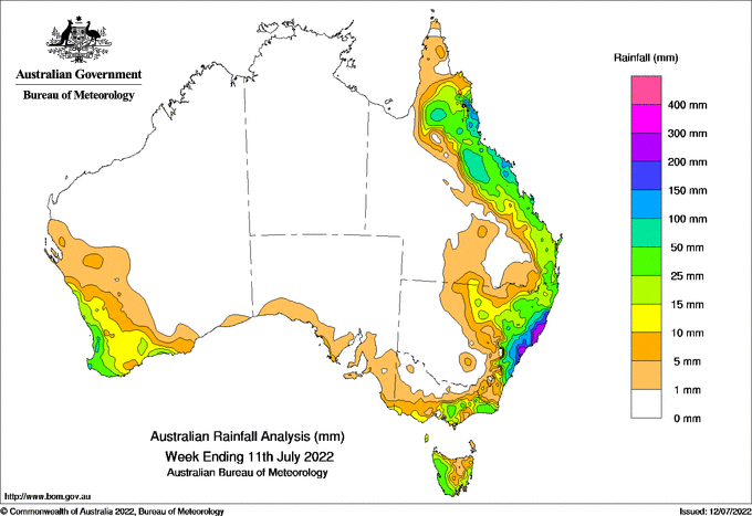
At the start of the week an East Coast Low off the New South Wales coast, that had already brought heavy rain from the Hunter to the Illawarra, decayed into a trough and moved northwards bringing further heavy rain
Significant flooding occurred in catchments, from the Illawarra to the Mid North coast, still saturated from extreme rainfall earlier this year
Many sites from Sydney to the Mid North Coast set July daily rainfall records, with weekly totals of 150-300 mm
The highest weekly total for the 5-11 July period at a Bureau gauge was 389.8 mm at Taree Airport AWS
Taree Airport AWS recorded 305.0 mm in the 24 hours to 9 am 7 July the highest daily total ever reported (for any month) in Taree, with observations starting in 1881
There were weekly totals of 50-100 mm, with higher totals locally, along the eastern Queensland coast from a cloundband early in the week, over 5 times the July monthly average for much of the Gulf Country and Northern Goldfields
Weekly totals of 25-50 mm for were recorded in coastal areas of south-west Western Australia, western Tasmania and East Gippsland in Victoria from the passage of cold fronts, with some sites in south-west Western Australia recording up to 90 mm


HAVE YOUR SAY