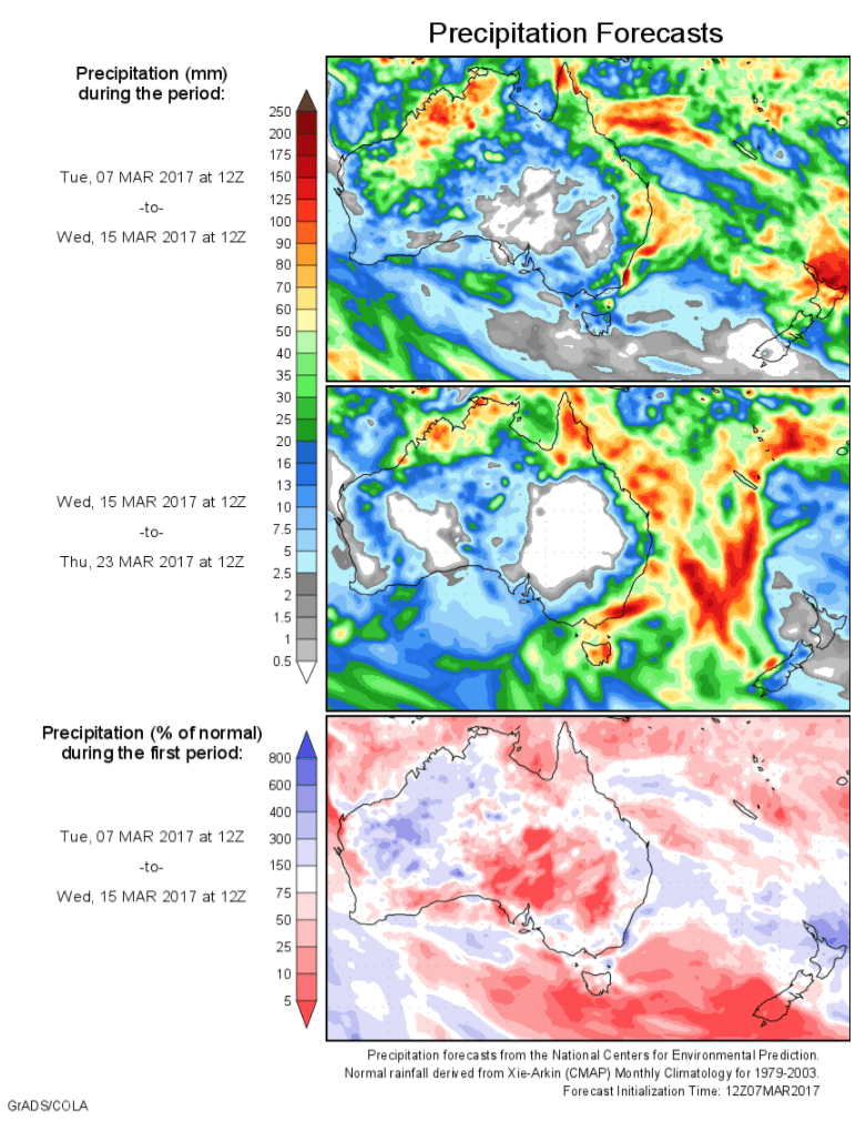
Today’s 14-day rainfall outlook – scroll to bottom of article
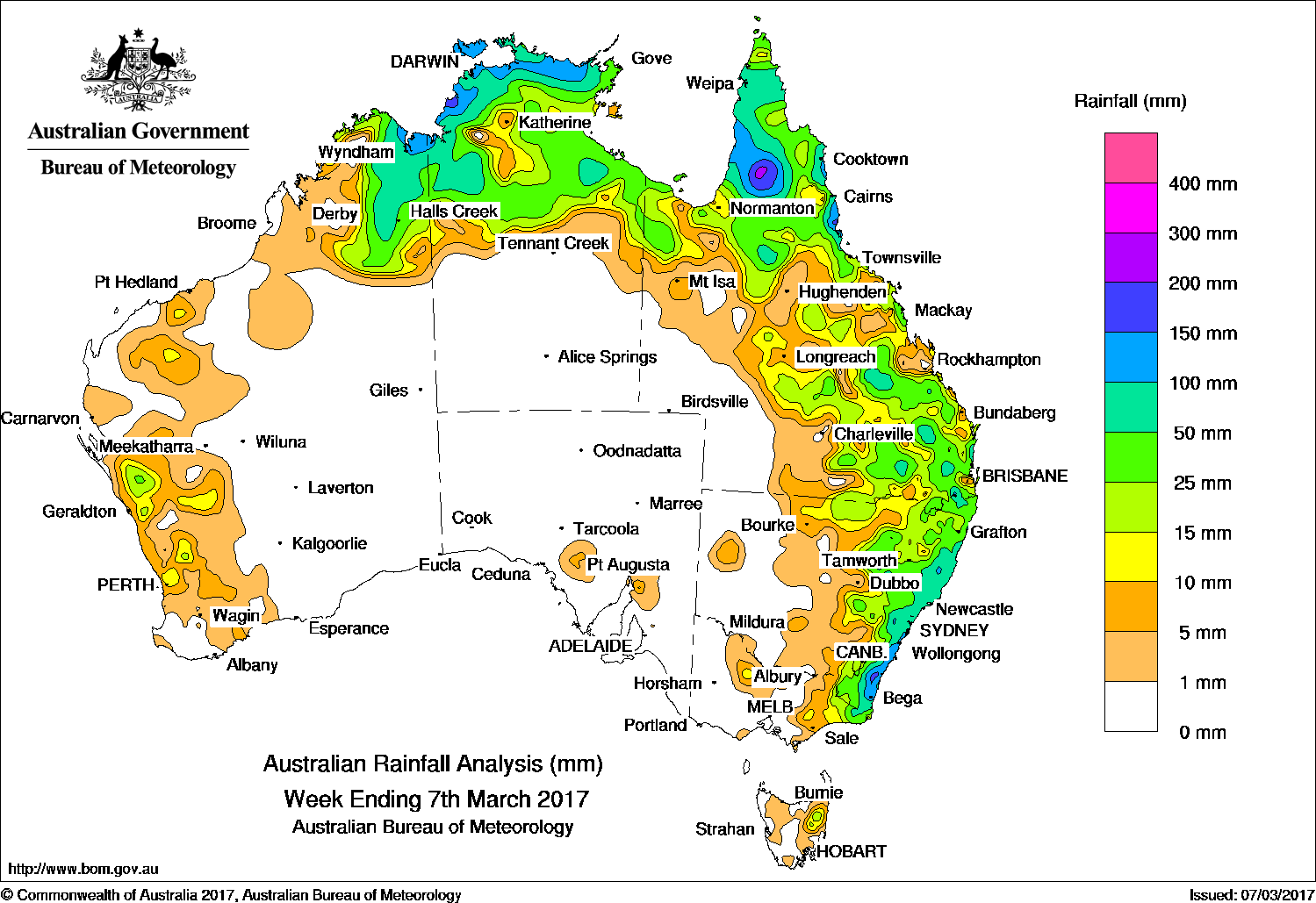
Rainfall over the past week was recorded across northern and eastern Australia, with isolated light to moderate falls along the west coast of Western Australia.
Past seven days: A humid air mass and broad area of low pressure persisted over northern Australia during the week, with showers and thunderstorm activity over Cape York Peninsula, the Top End of the Northern Territory and the Kimberley in Western Australia.
At the start of the week, thunderstorms developed in the vicinity of a surface trough located along the west coast of Western Australia, producing mainly light to moderate falls. A moist easterly airstream fed into a surface low pressure trough situated off the New South Wales coast, and interacted with a complex upper-level trough. Showers and isolated thunderstorms brought moderate falls to coastal parts of New South Wales and southeastern Queensland.
By the middle of the week, the low pressure system deepened along the surface trough, producing moderate to heavy falls along the south coast of New South Wales, in far eastern Victoria, and an area of northeast Tasmania. Thunderstorms and showers formed near and east of a surface trough extending through inland Queensland and New South Wales, with moderate falls recorded over central and southern parts of Queensland, as well as northern and eastern New South Wales.
At the end of the week, an intensifying tropical low north off the Top End developed into tropical cyclone Blanche. The system tracked southwest across the Timor Sea, then crossed the north Kimberley coast, producing storms and showers with moderate to heavy rainfall totals across northern Australia – from the Kimberley in Western Australia, to the Cape York Peninsula in Queensland.
Rainfall totals in excess of 150 mm were recorded in the Darwin–Daly district in the Northern Territory, areas of the Cape York Peninsula and north tropical coast of Queensland, as well as the south coast of New South Wales. The highest weekly total of 258 mm at Yarras (Mount Seaview) in New South Wales.
Rainfall totals between 50 mm and 150 mm were recorded in the eastern Kimberley, the northern Top End of the Northern Territory, much of the Cape York Peninsula and north east tropics, and pockets of the southeastern quarter of Queensland. Similar totals were recorded in pockets of northeastern New South Wales and along much of the State’s east coast; with higher falls between 100 mm and 150 mm recorded along the south east coast of New South Wales.
Rainfall totals between 10 mm and 50 mm were recorded in East Gippsland in eastern Victoria; much of the eastern half of New South Wales; central and southeastern Queensland; across northern Australia from the Kimberley in Western Australia, the northern half of the Northern Territory, and north Queensland; along the southwest coast of Western Australia, and an area of northeast Tasmania.
Little or no rainfall was recorded in South Australia, Victoria away from the east, Tasmania except the northeast, much of central and southeastern Western Australia, the southern half of the Northern Territory, and southwest Queensland.
Highest weekly totals
New South Wales and Australian Capital Territory
258 mm Yarras (Mount Seaview)
222 mm Beaumont (The Cedars)
202 mm Bendalong Stp
Victoria
60 mm Combienbar Aws
57 mm Combienbar
49 mm Club Terrace
Queensland
189 mm Archer River Roadhouse
162 mm Highbury Station
155 mm Noosaville
Western Australia
148 mm Bedford Downs Airstrip
112 mm Wyndham Aero
104 mm Carlton Hill
South Australia
13 mm Wirrabara
9 mm Wirrabara Forest
8 mm Hilltown, Steingarten Vineyard (Steingar
Tasmania
48 mm Upper Esk (South Esk River)
27 mm Fosterville
22 mm Llewellyn (South Esk River)
Northern Territory
203 mm Channel Point
155 mm Humpty Doo, Collard Road
152 mm Gunn Point, Darwin Airport
More weekly rainfall totals:
- NSW/ACT totals click here
- Vic totals click here
- Qld totals click here
- WA totals click here
- SA totals click here
- Tas totals click here
- NT totals click here
Source: BOM


HAVE YOUR SAY